Shipka (military base)
Appearance
| Shipka | |
|---|---|
| Ukraine | |
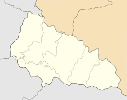
 Map of the installation | |
| Coordinates | 48°22′40″N 22°42′27″E / 48.37768°N 22.70744°E |
| Type | military installation |
| Code | RO-5 |
| Site information | |
| Condition | closed |
| Site history | |
| Built | 1970s |
| Built by | Soviet Union |
Shipka is a small Russian military base that serves the Soviet-installed Dnepr radar and located near the city of Mukachevo (just outside a small village of Shenborn) in Ukraine. Since 2009 the base was supposedly closed down by the Russian authorities who refused to continue paying for land-lease.[1]
References
- ^ SPRN Radar in Sevastopol ceased data transfer to Russia. Meridian Sevastopol. February 26, 2009
External links
- Ukraine will be blind. Ekonomichna Pravda (Ukrayinska Pravda). June 3, 2013
- Ukraine plans to install radars of new generation before 2017 - NKAU chairman. Interfax Ukraine. June 5, 2013
- Expedition to the secret Dnepr radar. Hi-way. March 2, 2007
- Zakarpattia: Dnepr radar to this day works for Russia. Zakarpattia Portal. November 6, 2008

