Spiennes
Appearance
Spiennes
Spiene (Walloon) | |
|---|---|
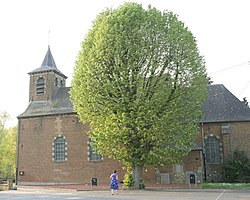
 Saint-Amand Church | |
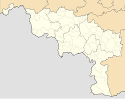
 Location of Spiennes in Mons | |
| Coordinates: 50°25′09″N 3°56′38″E / 50.41917°N 3.94389°E | |
| Country | |
| Community | |
| Region | |
| Province | |
| Arrondissement | Mons |
| Municipality | Mons |
| Area | |
| • Total | 5.370 km2 (2.073 sq mi) |
| Population (2024-01-01) | |
| • Total | 976 |
| • Density | 180/km2 (470/sq mi) |
| Postal codes | 7032 |
| Area codes | 065 |
Spiennes (French pronunciation: [spjɛn]; Walloon: Spiene) is a sub-municipality of the city of Mons located in the province of Hainaut, Wallonia, Belgium. It was a separate municipality until 1977. On 1 January 1977, it was merged into Mons.[1]
Heritage
[edit]The locality is well known for its neolithic flint mines,[2] which are on the list of UNESCO World Heritage Sites since 2000.
References
[edit]- ^ "LISTE ALPHABETIQUE DES COMMUNES - Fusions de 1963 à 1977" (PDF).
- ^ "Neolithic Flint Mines of Petit-Spiennes : Official web site". Archived from the original on 2007-12-31. Retrieved 2007-12-16.
Wikimedia Commons has media related to Spiennes.
- ^ "Spiennes (Mons, Hainaut Province (Sub-Municipalities), Belgium) - Population Statistics, Charts, Map, Location, Weather and Web Information". www.citypopulation.de. Retrieved 2024-10-31.


