
Swartberg
This article needs additional citations for verification. (January 2009) |

The Swartberg mountains (black mountain in Afrikaans) make up a mountain range that runs roughly east-west along the northern edge of the semi-arid Little Karoo in the Western Cape province of South Africa. To the north of the range lies the other large semi-arid area in South Africa, the Great Karoo.
There are several passes through the Swartberg Range, and these are famous due primarily to the spectacular geology they disect [1] as well as the engineering skill required in completing several of them [2][3]. Most famous of all is the Swartberg Pass which runs between Oudtshoorn in the south and Prince Albert in the north. The pass is not tarred and can be treacherous after rain, but offers spectacular views over the Little Karoo and the Great Karoo to the north, as well as astounding Geology. The Swartberg is regarded as one of the finest exposed fold mountain chains in the world, and the Northern end of the pass shows this especially [4]. The plant life along the pass is particularly interesting as many hundreds of species are found on the Swartberg. Also notable is the drystone work supporting some of its picturesque hairpin bends.
To the east of the Swartberg Pass, the Meiringspoort provides tarred road transit through the Swartberg along a river. The poort runs north out of the town of De Rust. The Meiringspoort offers a spectacular drive through incredible rock formations, and is the setting for an annual half marathon that ends in the town of De Rust.
Prince Albert hosts the annual Swartberg Pass Half Marathon. The race route goes out of the town and into the Swartberg Pass, with sheer rock and mountains on both sides. The warped and twisted rock formations are both beautiful and spectacular. This race is held usually on the first Saturday of May, to coincide with the Olive Festival.
Much of the Swartberg is part of a UNESCO World Heritage Site.
The Two Ranges

Most of the Swartberg Mountains are above 2000 m high, making it the tallest range of mountains in the Western Cape province. It is also one of the longest, spanning some 230 km from south of Laingsburg in the west to between Willowmore and Uniondale in the east.
The Swartberg consists of two officially named ranges, the Smaller and the Greater Swartberg Mountains. Ironically, the Smaller Swartberg Mountains, the westernmost of the two, is the higher one, including the province's highest peak, Seweweekspoortpiek (Seven Weeks Gorge Peak) at 2325 m. The famous Towerkop (Bewitch Peak) towers over the Klein Karoo town of Ladismith at a height of 2189 m. The peak is so named for its cleft peak, that, according to legend, was split by a spell and subsequent bolt of lightning.
The Greater Swartberg is to the east, with the dividing line between the two ranges being the Gouritz river, which cuts a gorge directly through the range. This section, almost of a similar height, is however slightly lower in elevation, with the Tierberg (Leopard Mountain) at 2132 m being the highest. These mountains are home to the Cango Caves, the most famous subterranean system in South Africa, located just north of Oudtshoorn.

Gallery
-
 Swartberg Mountains
 -
 Part of Swartberg Pass-
 -
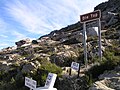 Top of the Pass (2004)
 -
 View from Pass
 -
 rock formations


33°22′00″S 22°21′15″E / 33.36667°S 22.35417°E
References
- ^ Geological Journeys. Norman, N. and Whitfield, G. 2006
- ^ http://www.tourismcapetown.co.za/ctru/content/en/us/full-article?oid=5633&sn=Detail&pid=2995&Cape-Karoo-and-Klein-Karoo-Mountain-Passes
- ^ http://www.patourism.co.za/swartberg%20pass.htm
- ^ Geological Journeys. Norman, N. and Whitfield, G. 2006