Taquile Island
| Geography | |
|---|---|
| Location | Lake Titicaca |
| Administration | |
Peru | |
| Demographics | |
| Population | about 1700 |
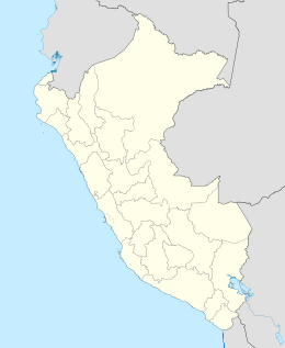
Taquile is an island on the Peruvian side of Lake Titicaca 45 km offshore from the city of Puno. About 2,200 people live on the island, which is 5.5 by 1.6 kilometres (3.4 by 1.0 mile) in size (maximum measurements), with an area of 5.72 km2 (2.21 sq mi). The highest point of the island is 4,050 metres (13,287 feet) above sea level and the main village is at 3,950 metres (12,959 feet). The inhabitants, known as Taquileños, speak Quechua.
In 2005, "Taquile and Its Textile Art" were honored by being proclaimed "Masterpieces of the Oral and Intangible Heritage of Humanity" by UNESCO.

Taquileños are known for their fine handwoven textiles and clothing, which are regarded as among the highest-quality handicrafts in Peru. Knitting is exclusively performed by males, starting at age eight. Women spin wool and use vegetables and minerals to dye the wool to be used by the community. Women are also the weavers of the Chumpis, the wide belts with woven designs worn by everyone in the community of Taquile. Taquileans are also known for having created an innovative, community-controlled sustainable tourism model, offering home stays, transportation, lodging for groups, cultural activities, local guides and restaurants. Ever since tourism started coming to Taquile in the seventies, the Taquileans slowly lost control over the mass day-tourism operated by non-Taquileans. Taquile community have their own Travel Agency Munay Taquile [1] has been established to regain local control over tourism.
Taquileños run their society based on community collectivism and on the Inca moral code ama sua, ama llulla, ama qhilla, (Quechua for "do not steal, do not lie, do not be lazy"). The island is divided into six sectors or suyus for crop rotation purposes. The economy is based on fishing, terraced farming horticulture based on potato cultivation, and tourist-generated income from the approximately 40,000 tourists who visit each year.
Taquile's families own rams, sheep, cows, chickens and sometimes guinea pigs. Taquile offers a wide range of typical dishes. Breakfast consists of two pancakes with sugar or bread with eggs, with a cup of tea made from either Muña or Coca. For lunch, dishes are a vegetable soup, fish with rice, and a tomato and onion salad. For dinner, the Taquilean people serve vegetable soup with bread.
The majority of the inhabitants on Taquile are Catholic. They adapted this religion, harmonizing their ancient culture with the syncretic Christian culture. The mother earth (Patchamama), the principal Andean deity, directly controls harvesting, fertility. People offer the deity a number of payments each year, and three coca leaves prior to each activity or trip. God is present throughout the year in the festivities. The two Catholic churches are in Centre and Huayllano; a Seventh-day Adventist church is located in Huayrapata.
Taquile has a radio station and is equipped with generators. Islanders have elected to use solar panels to generate energy.
Flowers and trees on the Island include Kolle, the tree used to roof the houses and for firewood, the Cantuta flower (the national flower of Peru), the Chukjo (used as detergent), and Muña, used as natural medicines. Coca leaves are not cultivated in Taquile.
Gallery
-
A festival on Taquile.
-
The annual Fiesta de Santiago.
-
Taquile, Puno, Perú. Mujer hilando.
-
Taquile - Peru - Lake Titicaca Children of Taquile.
-
The Arch leading to the main square of the island.
See also
Bibliography
- Kusikiy A Child from Taquile, Peru, 2010 ISBN 978-0-9844079-8-9
- Elayne Zorn, 2004. Weaving a Future: Tourism, Cloth and Culture on an Andean Island, Iowa City: University of Iowa Press. ISBN 0-87745-916-9
External links
 Media related to Taquile at Wikimedia Commons
- Munay Taquile - Community Based Travel Agency - owned by the people of the Taquile Island.


