Timóteo (municipality)
Appearance
Timóteo | |
|---|---|
Municipality | |
| Municipality of Timóteo | |
 View of the 31 de Outubro (31 October) Avenue seen from of the Bretas supermarket, in Timóteo, Minas Gerais, Brazil. | |
| Nickname(s): "A Capital do Inox" | |
 | |
| Country | |
| Region | Southeast |
| State | |
| Founded | April 29, 1964 |
| Government | |
| • Mayor | Keisson Drummond (PT) |
| Area | |
• Total | 145.159 km2 (56.046 sq mi) |
| Population (2009) | |
• Total | 81.118 |
| • Density | 524.2/km2 (1,358/sq mi) |
| Time zone | UTC-3 |
| HDI (2000) | 0,831 – high |
| Website | http://www.timoteo.mg.gov.br/ |
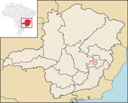
Timóteo is a Brazilian municipality in the state of Minas Gerais, located by the Piracicaba River. The population as of 2009 was 81,118 inhabitants. The city is situated in the metropolitan area of the Steel Valley (Vale do Aço). It is the hometown of Acesita, a steel factory specialized in the production of stainless steel, now named Aperam.


