Timworth
Appearance
| Timworth | |
|---|---|
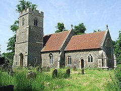
 St Andrew's church, Timworth | |
Location within Suffolk | |
| Population | 50 [1] |
| District | |
| Shire county | |
| Region | |
| Country | England |
| Sovereign state | United Kingdom |
| Post town | Bury St Edmunds |
| Postcode district | IP31 |
| Police | Suffolk |
| Fire | Suffolk |
| Ambulance | East of England |
Timworth is a village and civil parish 65 miles (104km) north east of London and 26 miles (42 km) east of Cambridge in the St Edmundsbury district of Suffolk, eastern England. Located around two miles north of Bury St Edmunds, its 2005 population was 50.[1] At the 2011 Census the appropriate Postal Code (IP31 1HS) showed the population as being included in Ampton.
The village name is Old English for ‘Enclosure of a man called *Tima’ and was mentioned in the Doomesday Book as Timeworda.[2]
In the early industrial revolution the village was the setting for the great Gleaning Case.
References
- ^ a b Estimates of Total Population of Areas in Suffolk Suffolk County Council
- ^ Answers.com. "Timworth Green". Retrieved 2 October 2012.
External links
![]() Media related to Timworth at Wikimedia Commons
Media related to Timworth at Wikimedia Commons

