Union Pacific Center
Appearance
| Union Pacific Center | |
|---|---|
 | |
 | |
| General information | |
| Status | Completed |
| Type | Union Pacific Corporate Headquarters |
| Location | 1400 Douglas Street Omaha, Nebraska 68179 United States |
| Coordinates | 41°15′33″N 95°56′07″W / 41.2593°N 95.9352°W |
| Completed | 2004 |
| Height | |
| Roof | 317 ft (97 m) |
| Technical details | |
| Floor count | 19 |
| Design and construction | |
| Architect(s) | Gensler (Design Architect) Kendall/Heaton Associates Inc. (Architect of Record) |
| Main contractor | Holder Construction Company |
| References | |
| [1] | |
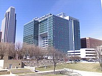
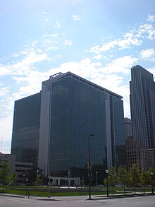
The Union Pacific Center at 1400 Douglas Street is one of downtown Omaha, Nebraska's newest high-rise buildings. It houses the headquarters of the Union Pacific Railroad and its parent company, the Union Pacific Corporation. It officially opened in June 2004 and rises 317 ft (97 m) making it the third tallest building in Omaha.[2] The old headquarters located directly across the street, was torn down in 2008 to make way for the new WallStreet Tower Omaha.[3]
 |
 |
References
See also
