
Unterleinleiter
Unterleinleiter | |
|---|---|
 Coat of arms | |
Location of Unterleinleiter within Forchheim district 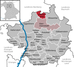 | |
 Unterleinleiter  Unterleinleiter | |
| Coordinates: 49°49′N 11°11′E / 49.817°N 11.183°E | |
| Country | Germany |
| State | Bavaria |
| Admin. region | Oberfranken |
| District | Forchheim |
| Municipal assoc. | Ebermannstadt |
| Government | |
| • Mayor | Gerhard Riediger |
| Area | |
| • Total | 12.48 km2 (4.82 sq mi) |
| Elevation | 319 m (1,047 ft) |
| Population (2022-12-31)[1] | |
| • Total | 1,160 |
| • Density | 93/km2 (240/sq mi) |
| Time zone | UTC+01:00 (CET) |
| • Summer (DST) | UTC+02:00 (CEST) |
| Postal codes | 91364 |
| Dialling codes | 09194 |
| Vehicle registration | FO |
| Website | www.unterleinleiter.de |
Unterleinleiter is a municipality in the district of Forchheim in Bavaria in Germany.
Towns and municipalities in Forchheim (district) | ||
|---|---|---|
|  | |
References
- ^ Genesis Online-Datenbank des Bayerischen Landesamtes für Statistik Tabelle 12411-003r Fortschreibung des Bevölkerungsstandes: Gemeinden, Stichtag (Einwohnerzahlen auf Grundlage des Zensus 2011) (Hilfe dazu).
| International | |
|---|---|
| National | |
This Forchheim district location article is a stub. You can help Wikipedia by expanding it. |