Varėnė
Appearance
This article relies largely or entirely on a single source. (July 2013) |
| Varėnė | |
|---|---|
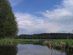
 Varėnė near Lake Varėnis | |
 | |
| Physical characteristics | |
| Source | |
| • location | Alytus district municipality, Alytus County |
| Mouth | |
• location | Merkys River |
| Length | 48 km (30 mi) |
| Basin size | 411 km2 (159 sq mi) |
| Discharge | |
| • average | 3.36 m3/s (119 cu ft/s) |
| Basin features | |
| Tributaries | |
| • left | Žiegždupis, Žižma, Dusmena, Musė |
| • right | Juodupė, Niedulė, Svetus, Abista |
Varėnė is a river of Alytus district municipality and Varėna district municipality, Alytus County, southern Lithuania. It flows for 48 kilometres and has a basin area of 411 km².
The Varėnė River begins near Skaičionys village. There are a lot of water springs at its upper course. Varėnė crosses the Varėnis Lake near its mouth. It joins the Merkys River near Varėna city.
Varėnė suits well for water tourism.
References
- LIETUVOS RESPUBLIKOS UPIŲ IR TVENKINIŲ KLASIFIKATORIUS (Republic of Lithuania- River and Pond Classifications). Ministry of Environment (Lithuania). Accessed 2011-11-11.
54°15′N 24°33′E / 54.250°N 24.550°E
