Vedvik
Appearance
Vedvik
Vedvika | |
|---|---|
Village | |
Location in Sogn og Fjordane | |
| Coordinates: 62°00′46″N 05°05′43″E / 62.01278°N 5.09528°E | |
| Country | Norway |
| Region | Western Norway |
| County | Sogn og Fjordane |
| District | Nordfjord |
| Municipality | Vågsøy Municipality |
| Elevation | 18 m (59 ft) |
| Time zone | UTC+01:00 (CET) |
| • Summer (DST) | UTC+02:00 (CEST) |
| Post Code | 6710 Raudeberg |
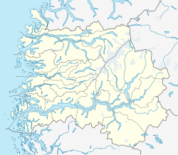
Vedvik or Vedvika is a village in Vågsøy Municipality in Sogn og Fjordane county, Norway. The village is located on the north side of the island of Vågsøy, about 2 kilometres (1.2 mi) northeast of the village of Refvika, 3 kilometres (1.9 mi) west of Langenes, and about 5 kilometres (3.1 mi) north of Raudeberg. The population (2001) of Vedvik is 156.[2]
Historically, Vedvik was an agricultural village focusing on milk production and sheep, but today most residents commute to Raudeberg or Måløy to work. There is still some farming, but now it is mostly cattle.
References
- ^ "Vedvika, Vågsøy" (in Norwegian). yr.no. Retrieved 2013-09-22.
- ^ Statistisk sentralbyrå (2001). "Folke- og boligtellingen 2001, kommune- og bydelshefter 1439 Vågsøy" (PDF) (in Norwegian).
{{cite journal}}: Cite journal requires|journal=(help)

