Vinkebrug
Appearance
52°23′N 4°43′E / 52.383°N 4.717°E
Vinkebrug | |
|---|---|
gehucht | |
 | |
 | |
| Country | Netherlands |
| Province | Noord-Holland |
| Municipality | Haarlemmerliede en Spaarnwoude |
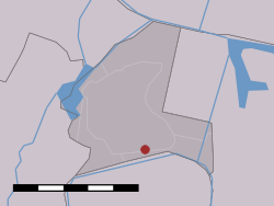
Vinkebrug is a town in the Dutch province of North Holland. It is a part of the municipality of Haarlemmerliede en Spaarnwoude, and lies about 6 km east of Haarlem.[1]
References
- ^ ANWB Topografische Atlas Nederland, Topografische Dienst and ANWB, 2005.
