
Wahlwiller
Wahlwiller | |
|---|---|
 | |
| Country | Netherlands |
| Province | Limburg |
| Municipality | Gulpen-Wittem |
| Population (1 November 2007) | 360 |
Wahlwiller is a village in the Dutch province of Limburg. It is located in the municipality of Gulpen-Wittem.[1] The village is located south of the Selzerbeek.
The name of the village is derived from villare, what means "belonging to a villa". In the 14th century the village is mentioned under names as Waelwilre, Wailwilre and Walwilre. The prefix "wael" indicates that the inhabitants were speaking a Walloon language.[2]
On the northern side of the village lies the Kruisberg, of Amstel Gold Race fame.[1]
-
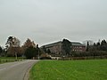 Arnold Janssen Monastery
 -
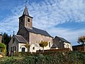 Cunibertus Church
 -
 Road cross on the Botterweck street


References
- ^ a b ANWB Topografische Atlas Nederland, Topografische Dienst and ANWB, 2005.
- ^ Template:Nl Wahlwiller
External links
50°48′39.09″N 5°56′19.26″E / 50.8108583°N 5.9386833°E
This Netherlands location article is a stub. You can help Wikipedia by expanding it. |