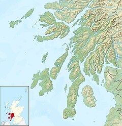
Whistlefield, Dunbartonshire
Appearance
| Whistlefield | |
|---|---|
Location within Argyll and Bute | |
| OS grid reference | NS236926 |
| • Edinburgh | 65 mi (105 km) |
| • London | 370 mi (600 km) |
| Council area |
|
| Country | Scotland |
| Sovereign state | United Kingdom |
| Post town | Helensburgh |
| Postcode district | G84 |
| Dialling code | 01436 |
Whistlefield is a location just north of Garelochhead on the B872 in Dunbartonshire, Scotland.[1] There is a roundabout known locally as the "Whistlefield roundabout" on the A814 road.[2] There is a viewpoint called the "Whistlefield viewpoint" with a picnic area and an associated carpark.[3]
There is a modern housing development in the location, with the B872 called "Whistlefield Road" in the area.[4]
Former railway station
[edit]Whistlefield station on the West Highland Railway opened in 1896 and closed in 1964.[5][6]
References
[edit]- ^ "Where is Whistlefield? Whistlefield on a map". www.getthedata.com.
- ^ "Whistlefield Roundabout - Roader's Digest: The SABRE Wiki". www.sabre-roads.org.uk.
- ^ "Unknown" (PDF).[permanent dead link]
- ^ Caldwell, David. "What you need to know about Whistlefield Road in the village of Garelochhead". Street List.
- ^ "Whistlefield is historic village". www.helensburgh-heritage.co.uk. Helensburgh Heritage Trust. 15 July 2012. Retrieved 12 August 2020.
- ^ "Portincaple, Whistlefield Station | Canmore".
External links
[edit]- Map sources for Whistlefield, Dunbartonshire

