
Winterburn Reservoir
| Winterburn Reservoir | |
|---|---|
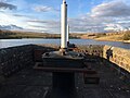
 Looking south across Winterburn Reservoir | |
| Location | North Yorkshire |
| Coordinates | 54°2′27″N 2°5′4″W / 54.04083°N 2.08444°W |
| Type | reservoir |
| Basin countries | United Kingdom |
Winterburn Reservoir is located near the village of Winterburn in Malhamdale, North Yorkshire, England. It was constructed between 1885 and 1893 by Leeds civil engineers Henry Rofe and Edward Filliter to help maintain levels on the Leeds and Liverpool Canal.[1] The cost of construction was estimated at £45,000.[2] Its capacity is 281,504,000 gallons and covers an area of 39.17 acres
In order to maintain the water levels of Winterburn and Eshton Beck, there is a compensation scheme. Around 5.5 million litres of water are discharged per day. The amount of compensation water is measured in the gauge house below the reservoir and further downstream at Holme Bridge lock, Gargrave.
In order to maintain the aquatic life in the reservoir, this is monitored daily, and in times of drought the water discharged into Winterburn Beck is reduced.
-
 Discharge portal into Winterburn beck.
 -
 Twin cast iron valve capstans


See also
References
External links
This Craven location article is a stub. You can help Wikipedia by expanding it. |