
Yumenoshima Park
| Yumenoshima Park | |
|---|---|
 Akahata festival in the park | |
 | |
| Location | Kōtō Ward, Tokyo, Japan |
| Coordinates | 35°38′58″N 139°49′33″E / 35.6493854°N 139.8258119°E |
| Area | 433,212 square metres (107.049 acres) |
| Created | 1 October 1978 |
| Public transit access | Shin-Kiba Station |
Yumenoshima Park (夢の島公園, Yumenoshima Kōen) is a sports park in Yumenoshima, Kōtō Ward, Tokyo, Japan. It was made by maintaining a landfill site called Yumenoshima, which was the final disposal site for garbage from 1957 until 1967.
Gallery
-
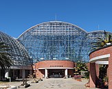 Yumenoshima Tropical Greenhouse Dome
 -
 Exhibition hall
 -
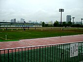 Looking at the pitch from the stands in the park
 -
 West entrance to the park


