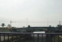
Brague
| Brague | |
|---|---|
 | |
 Course of the Brague | |
| Location | |
| Country | France |
| Région | Provence-Alpes-Côte d'Azur |
| Département | Alpes-Maritimes |
| Physical characteristics | |
| Mouth | Mediterranean Sea |
• location | near Antibes |
• coordinates | 43°36′28″N 7°07′38″E / 43.6078°N 7.1271°E |
| Length | 21.0 km (13.0 mi) |
| Basin features | |
| Tributaries | |
| • right | Valmasque |
The Brague is a river in the département of Alpes-Maritimes and the région of Provence-Alpes-Côte d'Azur in France. The Brague takes its source near Châteauneuf-Grasse and ends in the Mediterranean Sea near Antibes.
Between Valbonne and Biot, a 9-kilometre (6 mi) long path follows the river. Part of the Brague Valley is covered by a park called the "Parc Départemental de la Brague".
The Brague is 21.0 kilometres (13.0 mi) long.[1]
References[edit]
Wikimedia Commons has media related to Brague river.
