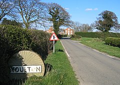
Youlton
| Youlton | |
|---|---|
 Entering the village of Youlton from the south west | |
Location within North Yorkshire | |
| OS grid reference | SE490634 |
| Unitary authority | |
| Ceremonial county | |
| Region | |
| Country | England |
| Sovereign state | United Kingdom |
| Post town | York |
| Postcode district | YO61 |
| Police | North Yorkshire |
| Fire | North Yorkshire |
| Ambulance | Yorkshire |
| UK Parliament | |
Youlton is a village and civil parish in Hambleton District of North Yorkshire, England. It is situated approximately 5 miles (8 km) south-west of Easingwold and 11 miles (18 km) from York. The population of the civil parish at the 2011 census was fewer than 100. Details are included in the civil parish of Aldwark.
History
[edit]The rights to the manor in the village used to belong to University College, Oxford. Amongst the previous landowners were the de Ros family. Youlton Hall was used by King James I as an overnight stop between London and Edinburgh.[1]
Governance
[edit]The village is within the Thirsk and Malton parliamentary constituency. It also lies within the Tollerton ward of Hambleton District Council and the Easingwold electoral district of North Yorkshire County Council.
Geography
[edit]The village lies midway between the River Ure and the River Kyle. Local roads link the village with Alne, North Yorkshire, to the north and Great Ouseburn to the west.[2]
References
[edit]- ^ Bulmer's Topography, History and Directory (Private and Commercial) of North Yorkshire 1890. S&N Publishing. 1890. p. 640. ISBN 1-86150-299-0.
- ^ "OpenData support | OS Tools & Support".
External links
[edit]![]() Media related to Youlton at Wikimedia Commons
Media related to Youlton at Wikimedia Commons

