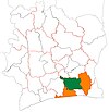
Taabo
Taabo | |
|---|---|
Town, sub-prefecture, and commune | |
| Coordinates: 6°14′N 5°8′W / 6.233°N 5.133°W | |
| Country | |
| District | Lagunes |
| Region | Agnéby-Tiassa |
| Department | Taabo |
| Area | |
| • Total | 572 km2 (221 sq mi) |
| Population (2021 census)[1] | |
| • Total | 57,189 |
| • Density | 100/km2 (260/sq mi) |
| Time zone | UTC+0 (GMT) |
Taabo is a town in southeastern Ivory Coast. It is a sub-prefecture of and the seat of Taabo Department in Agnéby-Tiassa Region, Lagunes District. Taabo is also a commune.
In 2021, the population of the sub-prefecture of Taabo was 57,189.[1]
Villages[edit]
The 14 villages of the sub-prefecture of Taabo and their population in 2014 are:[2]
- Ahondo (2 786)
- Kokoti-Kouamékro (1 696)
- Kotiessou (2 262)
- N'denou (2 499)
- Taabo (6 372)
- Taabo Village (4 935)
- Ahérémou 2 (2 055)
- Ahouati (1 857)
- Amani Ménou (4 729)
- Kathénou (915)
- Léléblé (5 300)
- Sahoua (1 496)
- Sokrogbo (1 911)
- Tokohiri (3 099)
References[edit]
- ^ a b Citypopulation.de Population of the regions and sub-prefectures of Ivory Coast
- ^ Citypopulation.de Population of the localities in the sub-prefecture of Taabo


