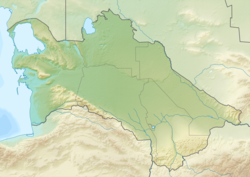
1948 Ashgabat earthquake
You can help expand this article with text translated from the corresponding article in Russian. Click [show] for important translation instructions.
|
| UTC time | 1948-10-05 20:12:09 |
|---|---|
| ISC event | 897583 |
| USGS-ANSS | ComCat |
| Local date | 6 October 1948 |
| Local time | 01:12:09 TMT |
| Magnitude | 7.3 Ms |
| Epicenter | 37°57′N 58°19′E / 37.95°N 58.32°E |
| Areas affected | Soviet Union (Turkmen SSR), Iran |
| Max. intensity | MMI X (Extreme)[1] |
| Casualties | 10,000–110,000[2] |
The 1948 Ashgabat earthquake (Turkmen: 1948 Ашгабат ертитремеси, romanized: 1948 Aşgabat ýertitremesi; Russian: Ашхабадское землетрясение 1948 года, romanized: Ashkhabadskoye zemletryasenie 1948 goda) was on 6 October with a surface wave magnitude of 7.3 and a maximum Mercalli intensity of X (Extreme), in Turkmenistan near Ashgabat. Due to censorship by the Soviet government, the event was not widely reported in the USSR's media. Historians tend to agree that the ban on reporting the extent of the casualties and damage did not allow the Soviet government to allocate enough financial resources to respond adequately.[3] It was the strongest earthquake recorded in Turkmenistan.
Details
The Ashgabat earthquake struck at 1:12 a.m. on October 6, 1948. The epicenter of the earthquake was near the small village of Gara-Gaudan, 25 kilometres southwest of Ashgabat. The earthquake caused extreme damage in Ashgabat and nearby villages, where almost all brick buildings collapsed, concrete structures were heavily damaged, and freight trains were derailed. There were damage and casualties in Darreh Gaz, Iran. Surface rupture was observed northwest and southeast of Ashgabat. Media sources vary on the number of the casualties, from 10,000 to 110,000, equivalent to almost 10% of the Turkmen SSR's population at the time.[4]
According to memories of survivors, the city's infrastructure was badly damaged, with the exception of water pipes. Telephone and telegraph service was cut. The city aerodrome's landing strip was cracked.[5]
Electricity was restored six days after the earthquake. The railway station began functioning on the third day. Because most motor vehicles were stored either under the open sky or in light plywood garages, most trucks and passenger automobiles were undamaged and proved critical to delivery of medicine and medical supplies from a destroyed pharmaceutical warehouse. All hospitals were destroyed, so medical treatment was rendered on the municipal parade ground "under the trees".[5]
This earthquake killed future Turkmen president Saparmurat Niyazov's mother Gurbansoltan Eje (his father having died during World War II) and the rest of his family, leaving him an orphan.[6] Aid to victims, as well as restoration of basic needs and infrastructure, was provided by the Soviet Army.
See also
- List of earthquakes in 1948
- List of earthquakes in Iran
- Halk Hakydasy Memorial Complex#Monument Ruhy Tagzym: monument to those who died in the earthquake
References
- ^ "Comments for the significant earthquake". Significant Earthquake Database. National Geophysical Data Center. Retrieved 12 June 2015.
- ^ USGS (September 4, 2009), PAGER-CAT Earthquake Catalog, Version 2008_06.1, United States Geological Survey
- ^ "List of the main Literature about the Ashkhabad Earthquake", Herald of the DGGGMS RAS, State registration number 0329700126, 2 (4), 1998, archived from the original on 2003-08-31
- ^ Sidorin, A. Ya. (2019-07-01). "Effects and Lessons of the 1948 Ashgabat Earthquake". Seismic Instruments. 55 (3): 271–282. doi:10.3103/S0747923919030113. ISSN 1934-7871. S2CID 195165654.
- ^ a b Nalivkin, Dmitriy Vasil'yevich (1989). Воспоминания об Ашхабадском Землетрясении 1948 года [Reminiscences of the Ashkhabad Earthquake of 1948] (PDF) (in Russian). Ashkhabad: Ylym – via academia.edu.
- ^ Cummings, Sally N. (2004). Power and Change in Central Asia. Taylor & Francis. p. 118. ISBN 978-0-203-16691-8.
Further reading
- Sidorin, A. Ya. (2019). "Effects and Lessons of the 1948 Ashgabat Earthquake". Seismic Instruments. 55 (3): 271–282. doi:10.3103/s0747923919030113. ISSN 0747-9239. S2CID 195165654.
External links
- The International Seismological Centre has a bibliography and/or authoritative data for this event.

