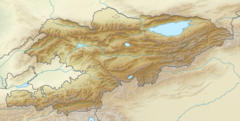
Ak-Jol (river)
| Ak-Jol Akjol | |
|---|---|
| Native name | Ак-Жол (Kyrgyz) |
| Location | |
| Country | Kyrgyzstan |
| Physical characteristics | |
| Mouth | Kara-Suu |
• coordinates | 41°32′57″N 72°08′21″E / 41.54917°N 72.13917°E |
| Length | 29 km (18 mi) |
| Basin size | 240 km2 (93 sq mi) |
| Discharge | |
| • average | 8 m3/s (280 cu ft/s) |
| Basin features | |
| Progression | Kara-Suu→ Naryn→ Syr Darya→ North Aral Sea |
The Ak-Jol (Kyrgyz: Ак-Жол) or (Kyrgyz: Акжол) is a left tributary of the Kara-Suu in Aksy District of Jalal-Abad Region, Kyrgyzstan. The river takes its rise in the south-west slopes of the Fergana Range. The Ak-Jol is 29 km (18 mi) long and has a catchment area of 240 km2 (93 sq mi). The average yearly discharge is 8 m3/s (280 cu ft/s). The maximum flow is in May-June and the minimum - in January - February. The river is used for irrigation. [1]
References[edit]
- ^ "Акжол" [Avletim] (PDF). Кыргызстандын Географиясы [Geography of Kyrgyzstan] (in Kyrgyz). Bishkek. 2004. p. 180.
{{cite encyclopedia}}: CS1 maint: location missing publisher (link)

