Batloun
This article relies largely or entirely on a single source. (May 2024) |
Batloun | |
|---|---|
 Old Batloun's Bridge | |
| Coordinates: 33°41′N 35°39′E / 33.683°N 35.650°E | |
| Country | |
| Governorate | Mount Lebanon |
| Area | |
| • Total | 5.5 km2 (2.1 sq mi) |
| Elevation | 1,250 m (4,100 ft) |
| Population | |
| • Total | 4,500 |
| Time zone | +2 |
| • Summer (DST) | +3 |
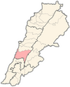
Batloun (Arabic: بتلون) is a village in the Chouf District in Mount Lebanon Governorate, Lebanon. Batloun is located 48 kilometers (30 miles) away from Beirut, the capital of Lebanon. It sits at an altitude of 1250 meters (4101 feet) above sea level and has an overall surface area of 5.5 square kilometers or about 550 hectares (2.1 square miles).[1]
Geography[edit]
Batloun is bordered by Kfar Nabrakh in the west, Jisr el Misri in the east, Mazraat El-Chouf in the south and Brih in the north.[1]
Population[edit]
Around 4500 people live in Batloun, of which 80% are permanent residents.[1]
Government[edit]
Batloun has a council with 12 members and a mayor. The council is divided into different committees, managing Work, Education, Culture and Delivery.[1]
Education[edit]
There is one public school[1]
Infrastructure[edit]
Telephone connections, a sewage disposal system and water are well established, but electricity is provided but is being restricted to a certain number of hours per week.[1]
Economy[edit]
The main sources of income are governmental jobs, aluminum manufacturing, metal welding and agriculture, which produces apples, peaches, cherries, figs, almonds and grapes, that are sold at the market in Sidon.[1]
References[edit]


