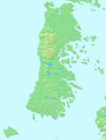
Caicumeo
Appearance
Caicumeo or Caycumeo was the local name of the Camino Real in Chiloé Island in Chile. It crossed through dense forest and swamps uniting Castro with Ancud.[1][2] The road was opened in 1788.[1] According to local lore the name would derive from a villager who cleared the track with the solely aided by a machete.[1] The road was established following the Spanish founded the "city-fort" of Ancud in northern Chiloé leading to increased trade and agricultural expansion.[2][3]
See also
References
- ^ a b c León León, Marco Antonio (2015). "Una Provincia "Enteramente Insular": Geografía, exploraciones y cotidianeidad en Chiloé Republicano, Chile (1826-1900)". Magallania. 43 (1). Retrieved 30 January 2016.
- ^ a b Sahady Villanueva, Antonio; Bravo Sánchez, José; Quilodrán Rubio, Carolina (2010). "Flandes Indiano Chiloense: un patrimonio invencible en el tiempo". Revista de Urbanismo (in Spanish). 23: 1–27. Archived from the original on 20 December 2016. Retrieved 30 January 2016.
- ^ Urbina Carrasco, María Ximena (2014). "El frustrado fuerte de Tenquehuen en el archipiélago de los Chonos, 1750: Dimensión chilota de un conflicto hispano-británico". Historia. 47 (I). Retrieved 28 January 2016.

