
Covenant Life, Alaska
Covenant Life, Alaska | |
|---|---|
| Country | United States |
| State | Alaska |
| Borough | Haines |
| Area | |
| • Total | 26.3 sq mi (68.1 km2) |
| • Land | 26.1 sq mi (67.6 km2) |
| • Water | 0.2 sq mi (0.5 km2) |
| Elevation | 259 ft (79 m) |
| Population (2000) | |
| • Total | 102 |
| Time zone | UTC-9 (Alaska (AKST)) |
| • Summer (DST) | UTC-8 (AKDT) |
| Area code | 907 |
| FIPS code | 02-17670 |
| GNIS feature ID | 1866938 |
Covenant Life is a census-designated place (CDP) in Haines Borough, Alaska, United States. At the 2000 census the population was 102. It is a community of people with common religious beliefs, with a panel of church elders who set policy for the community's common church, K-12 school, and private 4-year university, and a loose form of self- (municipal) government. An emphasis for community living is a key value in their lifestyle, such as taking most meals together in a common meeting place. The community was establish during a Christian religious movement in the 1960s and 1970s, where many such communities were established in Alaska and Canada, with emphasis on self-sufficiency and at least partial agricultural independence. The latter lends to the term often used by outsiders as "The Farm", in reference to a single such community. Modern technology is not forbidden, nor discouraged, but due to remoteness and complete lack of public utilities, it is present much less so than in American and Canadian culture.
Geography
Covenant Life is located at 59°24′0″N 136°4′35″W / 59.40000°N 136.07639°W (59.400046, -136.076433)Template:GR.
According to the United States Census Bureau, the CDP has a total area of 26.3 square miles (68 km2), of which, 26.1 square miles (68 km2) of it is land and 0.2 square miles (0.52 km2) of it (0.76%) is water.
Demographics
As of the censusTemplate:GR of 2000, there were 102 people, 25 households, and 22 families residing in the CDP. The population density was 3.9 people per square mile (1.5/km²). There were 38 housing units at an average density of 1.5/sq mi (0.6/km²). The racial makeup of the CDP was 94.12% White, 0.98% Native American, 3.92% Asian, and 0.98% from two or more races.
There were 25 households out of which 44.0% had children under the age of 18 living with them, 84.0% were married couples living together, 4.0% had a female householder with no husband present, and 12.0% were non-families. 4.0% of all households were made up of individuals and none had someone living alone who was 65 years of age or older. The average household size was 4.08 and the average family size was 3.59.
In the CDP the population was spread out with 26.5% under the age of 18, 15.7% from 18 to 24, 18.6% from 25 to 44, 32.4% from 45 to 64, and 6.9% who were 65 years of age or older. The median age was 35 years. For every 100 females there were 75.9 males. For every 100 females age 18 and over, there were 63.0 males.
The median income for a household in the CDP was $34,167, and the median income for a family was $41,250. Males had a median income of $36,875 versus $22,083 for females. The per capita income for the CDP was $14,326. There were 4.5% of families and 15.2% of the population living below the poverty line, including no under eighteens and 12.5% of those over 64.
References
59°24′00″N 136°04′35″W / 59.400046°N 136.076433°W
Municipalities and communities of Haines Borough, Alaska, United States | ||
|---|---|---|
| CDPs | 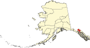 | |