Croftamie
Croftamie
| |
|---|---|
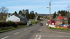
 The main road through Croftamie | |
Location within the Stirling council area | |
| OS grid reference | NS476859 |
| Civil parish | |
| Council area | |
| Lieutenancy area | |
| Country | Scotland |
| Sovereign state | United Kingdom |
| Post town | GLASGOW |
| Postcode district | G63 |
| Dialling code | 01360 |
| Police | Scotland |
| Fire | Scottish |
| Ambulance | Scottish |
| UK Parliament | |
| Scottish Parliament | |
Croftamie (Scottish Gaelic Croit Sheumaidh) is a small village near Drymen in Scotland.
The village was traditionally part of Dunbartonshire, but a minor change in boundaries means that it is now under Stirling Council.
Drymen station on the Forth and Clyde Junction Railway was situated in the village.

External links
Wikimedia Commons has media related to Croftamie.

