
Cullen, Louisiana
Cullen, Louisiana | |
|---|---|
Town | |
 Cullen Municipal Building | |
 Location of Cullen in Webster Parish, Louisiana. | |
.svg) Location of Louisiana in the United States | |
| Coordinates: 32°58′10″N 93°26′53″W / 32.96944°N 93.44806°W | |
| Country | United States |
| State | Louisiana |
| Parish | Webster |
| Government | |
| Area | |
| • Total | 1.16 sq mi (3.00 km2) |
| • Land | 1.15 sq mi (2.99 km2) |
| • Water | 0.01 sq mi (0.02 km2) |
| Elevation | 249 ft (76 m) |
| Population (2020) | |
| • Total | 716 |
| • Density | 620.99/sq mi (239.78/km2) |
| Time zone | UTC-6 (CST) |
| • Summer (DST) | UTC-5 (CDT) |
| Area code | 318 |
| FIPS code | 22-18790 |
Cullen is a town just south of Springhill in northern Webster Parish, Louisiana, United States. The population was 1,163 at the 2010 census. It is part of the Minden Micropolitan Statistical Area.
Bobby Ray Washington, the former mayor of Cullen, served as president and vice president of the Louisiana Municipal Association. He resigned from office when questions arose about his residency in Shreveport.[2] Washington was succeeded in March 2012 by Dexter Turner, a former police detective in Springhill.[3] Turner was elected to a full term as mayor in December 2012 and died on March 22, 2013, of an apparent heart attack at the age of forty-nine.[4]
Cullen has a restored Kansas City Southern Railroad museum located across from the International Paper Company container plant.
In 2011, Ricky L. Thomas reactivated the Ludwig Ball Park, which had been constructed in 1968 for baseball and softball. After many years of neglect the park was restored and a reunion was held in July 2011; all former ball players were invited. At the reunion Thomas presented Coach Billy Dubois a framed picture of his Louisiana-Arkansas All Star team. KTBS, the ABC affiliate in Shreveport, aired a story about Ludwig Ball Park.
Charles Jacobs, judge of the Louisiana 26th Judicial District Court since 2015, is a former town attorney for Cullen.[5]
Geography[edit]
Cullen is located at 32°58′10″N 93°26′53″W / 32.96944°N 93.44806°W (32.969335, -93.448092).[6]
According to the United States Census Bureau, the town has a total area of 1.2 square miles (3.1 km2), all land.
Demographics[edit]
| Census | Pop. | Note | %± |
|---|---|---|---|
| 1960 | 2,194 | — | |
| 1970 | 1,956 | −10.8% | |
| 1980 | 1,869 | −4.4% | |
| 1990 | 1,642 | −12.1% | |
| 2000 | 1,296 | −21.1% | |
| 2010 | 1,163 | −10.3% | |
| 2020 | 716 | −38.4% | |
| U.S. Decennial Census[7] | |||
| Race | Number | Percentage |
|---|---|---|
| White (non-Hispanic) | 76 | 10.61% |
| Black or African American (non-Hispanic) | 619 | 86.45% |
| Other/Mixed | 11 | 1.54% |
| Hispanic or Latino | 10 | 1.4% |
As of the 2020 United States census, there were 716 people, 552 households, and 295 families residing in the town.
References[edit]
- ^ "2020 U.S. Gazetteer Files". United States Census Bureau. Retrieved March 20, 2022.
- ^ "Citizens Question Mayor's Residence and Dedication". KTBS.com. Retrieved August 25, 2011.[permanent dead link]
- ^ "Bonnie Culverhouse, "Cullen Mayor dies"". Minden Press-Herald. Retrieved March 25, 2013.
- ^ "Region Briefs: Funeral service set for Cullen mayor, March 26, 2013". Shreveport Times. Retrieved March 27, 2013.
- ^ "26th District judge race: Charles Jacobs". Bossier Press-Tribune. July 23, 2014. Retrieved July 4, 2015.
- ^ "US Gazetteer files: 2010, 2000, and 1990". United States Census Bureau. February 12, 2011. Retrieved April 23, 2011.
- ^ "Census of Population and Housing". Census.gov. Retrieved June 4, 2015.
- ^ "Explore Census Data". data.census.gov. Retrieved December 29, 2021.
Gallery[edit]
-
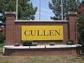 Cullen welcome sign
 -
 Restored Kansas City Southern Railroad museum in Cullen
 -
 The International Paper Company container plant in Cullen is a scaled-down version of a former pulpwood factory which located here in 1937
 -
 Cullen First Baptist Church is a Baptist Missionary Association of America congregation


Municipalities and communities of Webster Parish, Louisiana, United States | ||
|---|---|---|
| Cities |  | |
| Towns | ||
| Villages | ||
| Unincorporated communities | ||