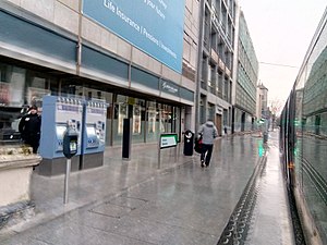
Dawson Luas stop
Appearance
 View of Dawson from a tram | ||||||||||||||
| General information | ||||||||||||||
| Location | Dublin Ireland | |||||||||||||
| Coordinates | 53°20′32″N 6°15′29″W / 53.342163539605345°N 6.2579558239071655°W | |||||||||||||
| Owned by | Transdev | |||||||||||||
| Operated by | Luas | |||||||||||||
| Line(s) | Green | |||||||||||||
| Platforms | 2 | |||||||||||||
| Construction | ||||||||||||||
| Structure type | At-grade | |||||||||||||
| Other information | ||||||||||||||
| Fare zone | Central | |||||||||||||
| Key dates | ||||||||||||||
| 09 December 2017 | Stop opened | |||||||||||||
| Services | ||||||||||||||
| ||||||||||||||
| ||||||||||||||
| |||||||||||||||||||||||||||||||||||||||||||||||||||||||||||||||||||||||||||||||||||||||||||||||||||||||||||||||||||||||||||||||||||||||||||||||||||||||||||||||||||||||||||||||||||||||||||||||||||||||||||||||||||||||||||||||||||||||||||||||||||||||||||||||||||||||||||||||||||||||||||||||||||||||||||||||||||||||||||||||||||||||||||||||||||||||||||||||||||||||||||||||||||||||
Dawson (Template:Lang-ga) is a stop on the Luas light-rail tram system in Dublin, Ireland. It opened in 2017 as the first stop on Luas Cross City, an extension of the Green Line through the city centre from St. Stephen's Green to Broombridge.[1] It is located on Dawson Street and provides access to the Grafton Street shopping district, the seat of the legislature at Leinster House on Kildare Street, St. Ann's Church, the Kerlin Gallery, Mansion House (the Lord Mayor's residence), and the National Library of Ireland. Its side platforms are integrated into the pavement.[2]
References
- ^ "Luas Cross City will open at 2pm on the 9th December". National Transport Authority.
- ^ "Dawson". Luas.

