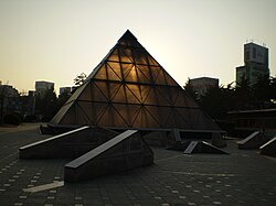
Dong District, Daegu
Dong District
동구 | |
|---|---|
| Korean transcription(s) | |
| • Hanja | 東區 |
| • Revised Romanization | Dong-gu |
| • McCune-Reischauer | Tong-gu |
 | |
 | |
| Country | South Korea |
| Region | Yeongnam |
| Provincial level | Daegu |
| Area | |
| • Total | 182.35 km2 (70.41 sq mi) |
| Population (2012.12.31) | |
| • Total | 342,092 |
| • Density | 1,900/km2 (4,900/sq mi) |
| • Dialect | Gyeongsang |
| Website | Dong District Office |
Template:Contains Korean text Dong District (Dong-gu) is a gu (district) in northeastern Daegu, South Korea. It has a population of 343,678.[1] The district covers 182.35 km², for about 20% of Daegu's total area.
Dong-gu first emerged as the "eastern district office" (동부출장소) in 1938. It achieved gu status in 1963. In 1998, the administrative divisions were reorganized, and the former 26 dong were reorganized as 20 dong.
Administrative divisions
- Ansim-dong
- Bangchon-dong
- Bullobongmu-dong
- Dongchon-dong
- Dopyeong-dong
- Gongsan-dong
- Haean-dong
- Hyomok-dong
- Jijeo-dong
- Sinam-dong
- Sincheon-dong
Sister cities
Notes and references
- ^ As of February 28, 2006. "동구 인구 수는 343,678명 (2006.2.28.기준)". Dong-gu website. Retrieved 2006-03-08.
