
February 2013 Great Plains blizzard
This article is missing information about Error: you must specify what information is missing.. (May 2013) |
| Type | Extratropical cyclone Winter storm Blizzard |
|---|---|
| Formed | February 19, 2013 |
| Dissipated | March 6, 2013[1] |
| Highest gust | 91 mph (146 km/h)[2] |
| Lowest pressure | 984 mb (29.1 inHg)[3] |
| Maximum snowfall or ice accretion | 34.5 in (88 cm)[4] |
| Damage | Unknown |
| Areas affected | Alaska, British Columbia, Pacific Northwest, Western United States, Great Plains, Eastern United States, Eastern Canada, Bermuda |
The February 2013 Great Plains blizzard was a powerful winter storm that affected the Great Plains, and much of the United States.
Meteorological history
On February 19, 2013, an extratropical disturbance developed in the Gulf of Alaska. Within the next few days, the system rapidly intensified, before attaining a minimum low pressure of 984 millibars on February 22. It was already affecting the Pacific Northwest, and because it was also forecasted to cause a lot more damage in the U.S. within the next week. After moving ashore in British Columbia, the storm weakened and shrunk considerably in size as it moved southeastwards into the southern Plains. On February 25, the storm began absorbing moisture coming from the Gulf of Mexico, and began to reintensify. The storm quickly became a blizzard, and leved out at 994 millibars. The blizzard's southern severe side spawned severe thunderstorms and several tornadoes on February 25. The storm began dumping ice in some parts of the midwest beginning on February 25. The system rapidly grew in size and continued to organize, before beginning to weaken later on February 26. Late on February 26, the blizzard began interacting with a much smaller storm to the west, which added extra moisture to the blizzard. The powerful blizzard turned northeastwards towards the Great Lakes region, and continued dumping snow across areas already impacted by another winter storm the week before.[7][8] On February 27, the blizzard absorbed the smaller storm to the west. At the same time, the storm spawned a secondary low along its frontal boundary, over the Southeastern United States. The new storm intensified to 991 mbars as it moved off the coast of New England, while the blizzard's main low pressure area became a 1000 mbar cut-off low over the Great Lakes, while continuing to steadily weaken. Despite this, the blizzard continued producing powerful winds, and dumping large amounts of snow and ice. A maximum wind gust of 91 mph was reported in Cedar Key, Florida. The blizzard also spawned a waterspout over downtown Tampa, Florida, which came ashore as an EF-0 tornado.[2] The storm systems continued dumping large amounts of snow, icy mix, and rain across most of the Eastern United States, while slowly moving eastward.[4] The snowfall totals from the blizzard combined with the previous winter storm greatly exceeded the snowfall totals of 2012, with many states in the Great Plains receiving record amounts of snow.[9] On February 28, the blizzard shrunk in size and developed 2 smaller circulations within the storm, as it continued weakening. The blizzard moved over New England and lost much of its moisture, as it continued moving towards the northeast. The blizzard absorbed the smaller secondary ciruculations, while the main secondary low moved out into the Atlantic Ocean. Over the next few days, the blizzard stalled over Nova Scotia, and rapidly weakened into a weak winter storm, while bringing snow showers to the northeast. The storm became a mostly rain system on Monday, March 4, but slightly restrengthened, and developed a few smaller circulations. Later, the storm slowly began to weaken again. On March 5, the storm moved out to sea, with a few lingering rain and snow showers in the northeast. On March 5, the blizzard rapidly moved northeastward, and on March 6, the blizzard was later absorbed by a larger extratropical system to the east of Europe.[1]
Impact
This section needs expansion. You can help by adding to it. (November 2014) |
A 400-mile stretch of Interstate 40 between Sayre, Oklahoma and Albuquerque, New Mexico was closed for two days due to whiteout conditions, leaving hundreds of trucks stranded on either end of the closure.
References
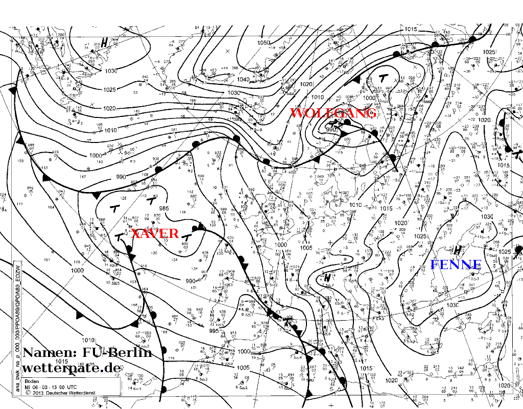
- ^ a b http://www.met.fu-berlin.de/de/wetter/maps/Analyse_20130306.gif
- ^ a b "Winter Storm Rocky Blamed for 6 Deaths". weather.com. Retrieved 2013-03-08.
- ^ Sean Ryan (February 25, 2013). "Storm Summary Message Number 4". Hydrometeorological Prediction Center. Retrieved February 25, 2013.
- ^ a b "Winter Storm Rocky: Snow Reports and Notables". weather.com. Retrieved 2013-03-08.
- ^ Staff Writer (February 25, 2013). "Roof collapse kills 1 in Woodward". KOCO News. Retrieved February 25, 2013.
- ^ Ahmed Shaaban (February 25, 2013). "21-year-old dies as vehicle overturns". Khaleej Times. Retrieved February 25, 2013.
- ^ https://web.archive.org/20130228005451/http://www.weather.com/news/weather-winter/winter-storm-rocky-west-midwest-northeast-20130222. Archived from the original on February 28, 2013. Retrieved February 28, 2013.
{{cite web}}: Missing or empty|title=(help); Unknown parameter|deadurl=ignored (|url-status=suggested) (help) - ^ "Winter Storm Rocky: State-by-State Impacts". weather.com. Retrieved 2013-03-08.
- ^ "Doubling, Tripling, Quadrupling Last Winter's Snow". weather.com. Retrieved 2013-03-08.