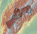
File:Altiplano Cundiboyacense (subdivisions).png
Appearance

Size of this preview: 652 × 600 pixels. Other resolutions: 261 × 240 pixels | 522 × 480 pixels | 835 × 768 pixels | 1,114 × 1,024 pixels | 1,740 × 1,600 pixels.
Original file (1,740 × 1,600 pixels, file size: 6.57 MB, MIME type: image/png)
File history
Click on a date/time to view the file as it appeared at that time.
| Date/Time | Thumbnail | Dimensions | User | Comment | |
|---|---|---|---|---|---|
| current | 20:32, 6 April 2013 |  | 1,740 × 1,600 (6.57 MB) | Dr Brains | User created page with UploadWizard |
File usage
The following 46 pages use this file:
- Altiplano Cundiboyacense
- Aquiminzaque
- Bacatá
- Battle of Chocontá
- Battle of Pasca
- Battle of Tocarema
- Bogotá savanna
- Checua
- Chicamocha River
- Duitama
- Eastern Hills (Bogotá)
- Gyalideopsis chicaque
- Herrera Period
- History of Bogotá
- Hunzahúa
- List of Muisca and pre-Muisca sites
- Meicuchuca
- Michuá
- Muisca
- Muisca Confederation
- Muisca art
- Muisca astronomy
- Muisca religion
- Muisca warfare
- Nemequene
- Nompanim
- Ocetá Páramo
- Paja Formation
- Quemuenchatocha
- Ritoque Formation
- Sabana Formation
- Sagipa
- Saguamanchica
- Sogamoso
- Spanish conquest of the Muisca
- Sugamuxi
- Tibitó
- Tisquesusa
- Tundama
- Tunja
- Women in Muisca society
- Template:History of the Muisca
- Template:Timeline of inhabitation of the Altiplano Cundiboyacense
- Module:Location map/data/Altiplano Cundiboyacense
- Module:Location map/data/Colombia Altiplano Cundiboyacense
- Module:Location map/data/Colombia Altiplano Cundiboyacense/doc
Global file usage
The following other wikis use this file:
- Usage on es.wikipedia.org
- Usage on nl.wikipedia.org
- Usage on si.wikipedia.org
- Usage on uz.wikipedia.org

