Golden Bay / Mohua
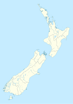
Golden Bay is a shallow, paraboloid shaped bay at the northwest end of New Zealand's South Island. An arm of the Tasman Sea, the bay lies southwest of Cook Strait and west of Tasman Bay. It is separated from the sea by the Farewell Spit. The Aorere and Takaka Rivers flow into the bay from the south.
It is known for being a popular tourist destination, because of its good weather and relaxed, friendly lifestyle.
The west and northern regions of the bay are largely unpopulated. Along its southern coast are the towns of Takaka and Collingwood, and also the Abel Tasman National Park. Separation Point, the natural boundary between Golden and Tasman Bays is situated within the park.
In December 2011, it (as well as much of the Nelson/Tasman region) was hit by heavy rain and flooding, which affected many homes around the Pohara/Ligar Bay/Tata Beach/Wainui area. The road to Totaranui, a popular isolated tourist destination was badly damaged and was reopened on 29 June 2012. The floods meant a loss of custom for many shops and businesses in the peak tourist season. By June 2012, the entirety of Golden Bay was open and operating as normal.
Its beaches are popular locations for retirees and holiday-homes.
It is located in the Tasman Region, one of the territorial authorities of New Zealand.
History
Dutch explorer Abel Tasman anchored in this bay in 1642, and, following a bloody encounter with the local Māori when a party from his ships tried to go ashore, named it Moordenaar's Bay (Murderers Bay). In 1770, during his first voyage, English explorer James Cook included the bay as part of Blind Bay, but upon his second voyage to the bay in 1773 realised that it was in fact the location of Murderers Bay. The French explorer Jules Dumont d'Urville appears to have changed the name to Massacre Bay. In the 1840s, following the discovery of coal in the region, it was known as Coal Bay. Then, in the 1850s, with the discovery of gold in Collingwood, its name was changed to the current name of Golden Bay.[1]
 |
 |
 |
References
- ^ McLintock, A. H. (1966). "Golden Bay". Te Ara. Retrieved 14 September 2010.
{{cite web}}: More than one of|author=and|last=specified (help)

