
Harrison, Tennessee
Harrison, Tennessee | |
|---|---|
 Location of Harrison, Tennessee | |
| Country | United States |
| State | Tennessee |
| County | Hamilton |
| Area | |
| • Total | 9.0 sq mi (23.3 km2) |
| • Land | 7.1 sq mi (18.5 km2) |
| • Water | 1.8 sq mi (4.8 km2) |
| Elevation | 768 ft (234 m) |
| Population (2010) | |
| • Total | 7,769 |
| • Density | 860/sq mi (330/km2) |
| Time zone | UTC-5 (Eastern (EST)) |
| • Summer (DST) | UTC-4 (EDT) |
| ZIP code | 37341 |
| Area code | 423 |
| FIPS code | 47-32600Template:GR |
| GNIS feature ID | 1286997Template:GR |
Harrison is a census-designated place (CDP) in Hamilton County, Tennessee, United States. The population was 7,769 at the 2010 census.Template:GR It is part of the Chattanooga metropolitan area. Harrison Bay State Park, the Hamilton County Landfill, Bear Trace Golf Course, a course designed by Jack Nicklaus, and Skull Island, a recreational area owned by TVA, are all located in Harrison.
Geography
Harrison is located at 35°7′9″N 85°8′58″W / 35.11917°N 85.14944°W (35.119296, -85.149487)Template:GR.
According to the United States Census Bureau, the CDP has a total area of 9.0 square miles (23 km2), of which, 7.1 square miles (18 km2) of it is land and 1.8 square miles (4.7 km2) of it (20.57%) is water.
History
The town developed southeast of Vann's Ferry (Vann Town), a ferry crossing established by James Vann, a prominent Cherokee trader and planter. It was later named Harrison after President William Henry Harrison and became the seat of Hamilton County in 1840. The county seat was later moved to Chattanooga, Tennessee, after the Civil War.[1] The first post office was opened on June 16, 1841. In 1870 the Hamilton County Courthouse was moved from Harrison to Chattanooga.[2]
Harrison's borders were once larger than today. When the Chickamauga Dam was completed on the Tennessee River by the Tennessee Valley Authority in 1940, much of the city was flooded, as portrayed in the 1960 movie Wild River. Some parts of the old city, such as old building foundations, roads, and guard rails, can still be seen, especially in and around Harrison Bay.[citation needed]
Demographics

As of the censusTemplate:GR of 2000, there were 7,630 people, 2,856 households, and 2,281 families residing in the CDP. The population density was 1,046.0 people per square mile (404.1/km²). There were 2,956 housing units at an average density of 405.2/sq mi (156.6/km²). The racial makeup of the CDP was 84.59% White, 12.94% African American, 0.35% Native American, 0.69% Asian, 0.01% Pacific Islander, 0.26% from other races, and 1.15% from two or more races. Hispanic or Latino of any race were 1.17% of the population.
There were 2,856 households out of which 35.0% had children under the age of 18 living with them, 65.8% were married couples living together, 10.6% had a female householder with no husband present, and 20.1% were non-families. 16.6% of all households were made up of individuals and 5.1% had someone living alone who was 65 years of age or older. The average household size was 2.67 and the average family size was 3.00.
In the CDP the population was spread out with 24.9% under the age of 18, 7.8% from 18 to 24, 29.9% from 25 to 44, 27.4% from 45 to 64, and 9.9% who were 65 years of age or older. The median age was 38 years. For every 100 females there were 93.8 males. For every 100 females age 18 and over, there were 92.0 males.
The median income for a household in the CDP was $49,393, and the median income for a family was $55,412. Males had a median income of $35,332 versus $27,487 for females. The per capita income for the CDP was $22,893. About 1.7% of families and 3.1% of the population were below the poverty line, including 1.4% of those under age 18 and 6.7% of those age 65 or over.
Parks and recreation
Harrison Bay State Park is located in Harrison. It is a 1200 acre park that was developed in the 1930s and covers part of the Chickamauga Lake shoreline. Other recreation located nearby are: Skull Island (Birchwood), Booker T. Washington State Park (Bartlebaugh) and an assortment of Civil War Parks and other tourist attractions in and around Chattanooga.[2]
Education
The Hamilton County Schools operates five schools in this area: Harrison Elementary School,[3] Brown Middle School,[4] Chattanooga Central High School,[5] and Hamilton County High School.[citation needed]
References
- ^ Charles McGehee Wake of the Flood PhD diss 1985
- ^ a b "IMAGES From Nostalgiaville TENNESSEE- HAMILTON COUNTY, TN". Tennessee. Nostalgiaville. Retrieved 12 November 2011.
- ^ "Harrison Elementary". Harrison Elementary. Retrieved 12 November 2011.
- ^ "Brown Middle School". Brown Middle School. Retrieved 12 November 2011.
- ^ "Chattanooga Central High School". Chattanooga Central High School. Retrieved 12 November 2011.
Municipalities and communities of Hamilton County, Tennessee, United States | ||
|---|---|---|
| Cities | 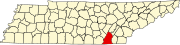 | |
| Towns | ||
| CDPs | ||
| Unincorporated communities | ||
| Footnotes | ‡This populated place also has portions in an adjacent county or counties | |