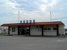
Hateruma


Hateruma (波照間島; Hateruma-jima; Yaeyama: Hatirōma Okinawan: Hatiruma) is an island in the Yaeyama District of Okinawa Prefecture, Japan. Part of the town Taketomi, it is the southern-most inhabited island in Japan at 24°2’25” north latitude, 123°47’16” east longitude. Hateruma, composed of corals, which has 12.7 km² of area and approximate 600 inhabitants.
The primary products of the island include sugarcane, refined sugar, and Awanami, a highly-prized type of the alcoholic beverage awamori. Its southern location makes it one of the few places in Japan where the Southern Cross can be observed.
Hateruma Airport serves the island.
References
- 美しき島々 ~波照間島~ (Japanese page)
- 美ら島物語 波照間島情報 (Japanese page)
See also
- Extreme points of Japan
- Paipatirōma (南波照間島, Paipatirōma-jima)
