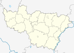
Kharlamovo
Kharlamovo
Харламово | |
|---|---|
Village | |
| Coordinates: 55°14′28″N 40°37′41″E / 55.24111°N 40.62806°E | |
| Country | Russia |
| Region | Vladimir Oblast |
| District | Gus-Khrustalny District |
| Time zone | UTC+3:00 |
Kharlamovo (Russian: Харламово) is a rural locality (a village) in Posyolok Velikodvorsky, Gus-Khrustalny District, Vladimir Oblast, Russia. The population was 4 as of 2010.[1]
Geography[edit]
Kharlamovo is located on the Dandur River, 52 km south of Gus-Khrustalny (the district's administrative centre) by road. Velikodvorye is the nearest rural locality.[2]
References[edit]
- ^ Всероссийская перепись населения 2010 года. Численность населения по населённым пунктам Владимирской области Archived 2016-03-05 at the Wayback Machine. Retrieved 2014-07-21.
- ^ Расстояние от Харламова до Гусь-Хрустального


