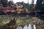
List of Places of Scenic Beauty of Japan (Hyōgo)

From Wikipedia, the free encyclopedia

This is list of the Places of Scenic Beauty of Japan located within the Prefecture of Hyōgo.[1]

National Places of Scenic Beauty[edit]

As of 1 July 2020, nine Places have been designated at a national level.[2][3][4]

Site Municipality Comments Image Coordinates Type Ref.
Anyō-in Gardens
安養院庭園
Anyō-in teien
Kobe 34°41′45″N 135°03′59″E / 34.695938°N 135.066269°E / 34.695938; 135.066269 (Anyō-in Gardens) 1 [1]
Former Akō Castle Gardens
旧赤穂城庭園
Kyū-Akō-jō teien
Akō designation includes the Honmaru Gardens (本丸庭園) and Ninomaru Gardens (二之丸庭園) 34°44′46″N 134°23′13″E / 34.74608887°N 134.38684376°E / 34.74608887; 134.38684376 (Former Akō Castle Gardens) 1 [2]
Former Ōoka-ji Gardens
旧大岡寺庭園
Kyū-Ōokaji teien
Toyooka 35°30′29″N 134°43′15″E / 35.50812276°N 134.72073714°E / 35.50812276; 134.72073714 (Former Ōokaji Gardens) 1 [3]
Keino-matsubara
慶野松原
Keino-matsubara
Minamiawaji 34°20′24″N 134°44′22″E / 34.34006611°N 134.73936675°E / 34.34006611; 134.73936675 (Keino-matsubara) 3, 8 [4]
Kasumi Coast
香住海岸
Kasumi kaigan
Kami 35°39′02″N 134°36′23″E / 35.6505098°N 134.60645887°E / 35.6505098; 134.60645887 (Kasumi Coast) 5, 8 [5]
Futatabi Park - Mount Futatabi Eikyū Vegetation Preservation Area - Kobe Municipal Foreign Cemetery
再度公園再度山永久植生保存地・神戸外国人墓地
Futata kōen・Futatabi-san Eikyū shokusei hozon-chi ・Kōbe gaikokujin bochi
Kobe 34°43′18″N 135°10′27″E / 34.72155624°N 135.17416824°E / 34.72155624; 135.17416824 (Futatabi Park - Mount Futatabi Eikyū Vegetation Preservation Area - Kobe Municipal Foreign Cemetery) 1 [6]
Tajima Mihonoura
但馬御火浦
Tajima Miho-no-ura
Kami, Shin'onsen also a National Monument 35°39′17″N 134°29′43″E / 35.65485393°N 134.49536633°E / 35.65485393; 134.49536633 (Tajima Mihonoura) 5, 8 [7]
Tabuchi Family Gardens
田淵氏庭園
Tabuchi-shi teien
Akō 34°43′52″N 134°24′27″E / 34.73106841°N 134.40755313°E / 34.73106841; 134.40755313 (Tabuchi Family Gardens) 1 [8]
Former Ekishūkan Gardens
旧益習館庭園
Kyū-Ekishūkan teien
Sumoto 34°20′22″N 134°53′41″E / 34.3395°N 134.89467°E / 34.3395; 134.89467 (Former Ekishūkan Gardens) 1 [9]

Prefectural Places of Scenic Beauty[edit]

As of 1 April 2020, nineteen Places have been designated at a prefectural level.[5][6]

Site Municipality Comments Image Coordinates Type Ref.
Taisan-ji Jōjū-in Gardens
太山寺成就院庭園
Taisan-ji Jōjū-in teien
Kobe 34°41′45″N 135°03′56″E / 34.695861°N 135.065682°E / 34.695861; 135.065682 (Taisan-ji Jōjū-in Gardens) for all refs see [10]
Former Ogawa Family Gardens
旧小河氏庭園
kyū-Ogawa-shi teien
Miki 34°47′44″N 134°58′59″E / 34.79567000°N 134.98300000°E / 34.79567000; 134.98300000 (Former Ogawa Family Gardens)
Shikagatsubo
鹿ケ壺
Shikagatsubo
Himeji 35°03′33″N 134°37′59″E / 35.059194°N 134.633083°E / 35.059194; 134.633083 (Shikagatsubo)
Mount Nagusa
七種山
Nagusa-yama
Fukusaki 35°00′47″N 134°41′56″E / 35.013127°N 134.698906°E / 35.013127; 134.698906 (Mount Nagusa)
Ōshō-ji Gardens
應聖寺庭園
Ōshōji teien
Fukusaki 34°58′50″N 134°43′18″E / 34.980608°N 134.721780°E / 34.980608; 134.721780 (Ōshōji Gardens)
Kanshō-ji Gardens
観正寺庭園
Kanshōji teien
Toyooka 35°38′01″N 134°49′35″E / 35.633742°N 134.826524°E / 35.633742; 134.826524 (Kanshōji Gardens)
Hiryū Falls and their vicinity
飛龍の滝及びその周辺
Hiryū-no-taki oyobi sono shūhen
Sayō 34°56′52″N 134°21′45″E / 34.947760°N 134.362493°E / 34.947760; 134.362493 (Hiryū Falls and their vicinity)
Hasakari-iwa
切浜の「はさかり岩」
Kirihama-no-Hasakari-iwa
Toyooka 35°39′35″N 134°44′19″E / 35.659639°N 134.738639°E / 35.659639; 134.738639 (Hasakari-iwa)
Sukyō-ji Hondō Gardens
宗鏡寺本堂庭園
Sukyōji hondō teien
Toyooka 35°27′47″N 134°52′48″E / 35.463134°N 134.879880°E / 35.463134; 134.879880 (Sukyōji Hondō Gardens)
Saruo Falls
猿尾滝
Saruo-daki
Kami 35°26′02″N 134°36′52″E / 35.433889°N 134.614444°E / 35.433889; 134.614444 (Saruo Falls)
Kirigataki Valley
霧が滝渓谷
Kirigataki keikoku
Shin'onsen 35°27′31″N 134°27′21″E / 35.458643°N 134.455769°E / 35.458643; 134.455769 (Kirigataki Valley)
Komata River Valley
小又川渓谷
Komata-gawa keikoku
Shin'onsen 35°29′14″N 134°26′30″E / 35.487197°N 134.441671°E / 35.487197; 134.441671 (Komata River Valley)
Enmyō-ji
円明寺庭園
Enmyōji teien
Asago 35°21′10″N 134°54′04″E / 35.352840°N 134.900994°E / 35.352840; 134.900994 (Enmyōji Gardens)
Enichi-ji Gardens
恵日寺庭園
Enichiji teien
Awaji 34°25′33″N 134°50′44″E / 34.425709°N 134.845462°E / 34.425709; 134.845462 (Enichiji Gardens)
Chōsen-ji Gardens
長泉寺庭園
Chōsenji teien
Awaji 34°29′43″N 134°51′51″E / 34.495274°N 134.864173°E / 34.495274; 134.864173 (Chōsenji Gardens)
Myōshō-ji Gardens
妙勝寺庭園
Myōshōji teien
Awaji 34°30′08″N 134°57′53″E / 34.502255°N 134.964686°E / 34.502255; 134.964686 (Myōshōji Gardens)
Jingū-ji Gardens
神宮寺庭園
Jingūji teien
Minamiawaji 36°22′49″N 139°26′25″E / 36.380290°N 139.440166°E / 36.380290; 139.440166 (Jingūji Gardens)
Gonen-ji
護念寺庭園
Gonenji teien
Asago 35°20′20″N 134°51′56″E / 35.339022°N 134.865428°E / 35.339022; 134.865428 (Gonenji Gardens)
Former Fukumoto Domain Ikeda Clan Jin'ya Gardens
福本藩池田家陣屋庭園
kyū-Fukumoto-han Ikeda-ke jin'ya teien
Kamikawa 35°03′37″N 134°46′25″E / 35.060283°N 134.773707°E / 35.060283; 134.773707 (Former Fukumoto Domain Ikeda Clan Jin'ya Gardens)

Municipal Places of Scenic Beauty[edit]

As of 1 May 2019, forty-two Places have been designated at a municipal level.[7]

Registered Places of Scenic Beauty[edit]

As of 1 July 2020, five Monuments have been registered (as opposed to designated) as Places of Scenic Beauty at a national level.[8][9]

Place Municipality Comments Image Coordinates Type Ref.
Ogawa Family Gardens
小河氏庭園
Ogawa-shi teien
Miki 34°47′44″N 134°58′59″E / 34.79567000°N 134.98300000°E / 34.79567000; 134.98300000 (Ogawa Family Gardens) [11]
Kajiwara Family Gardens
梶原氏(西梶原)庭園
Kajiwara-shi (Nishi-Kajiwara) teien
Himeji 34°46′45″N 134°45′34″E / 34.77922000°N 134.75940000°E / 34.77922000; 134.75940000 (Kajiwara Family Gardens) [12]
Sōraku-en
相楽園
Sōraku-en
Kobe 34°41′33″N 135°10′54″E / 34.69259000°N 135.18170000°E / 34.69259000; 135.18170000 (Sōraku-en) [13]
Higashi-yūenchi
東遊園地
Higashi-yūenchi
Kobe 34°41′19″N 135°11′46″E / 34.68852000°N 135.19620000°E / 34.68852000; 135.19620000 (Higashi-yūenchi) [14]
Mitoro-en Gardens
みとろ苑庭園
Mitoro-en teien
Kakogawa 34°48′02″N 134°53′56″E / 34.80066000°N 134.89880000°E / 34.80066000; 134.89880000 (Mitoro-en Gardens) [15]

See also[edit]

References[edit]

  1. ^ "Cultural Properties for Future Generations". Agency for Cultural Affairs. Retrieved 10 July 2020.
  2. ^ 史跡名勝天然記念物 [Number of Monuments of Japan by Prefecture] (in Japanese). Agency for Cultural Affairs. 1 July 2020. Retrieved 10 July 2020.
  3. ^ "Database of National Cultural Properties: 史跡名勝天然記念物 (名勝, 特別名勝 兵庫県 2県以上)" (in Japanese). Agency for Cultural Affairs. Retrieved 10 July 2020.
  4. ^ "国指定文化財一覧" [List of National Cultural Properties of Hyōgo Prefecture] (PDF). Hyōgo Prefecture. 1 April 2020. Retrieved 10 July 2020.
  5. ^ 都道府県別指定等文化財件数(都道府県分) [Number of Prefectural Cultural Properties by Prefecture] (in Japanese). Agency for Cultural Affairs. 1 May 2019. Retrieved 10 July 2020.
  6. ^ "県指定文化財一覧" [List of Prefectural Cultural Properties of Hyōgo Prefecture] (PDF). Hyōgo Prefecture. 1 April 2020. Retrieved 10 July 2020.
  7. ^ 都道府県別指定等文化財件数(市町村分) [Number of Municipal Cultural Properties by Prefecture] (in Japanese). Agency for Cultural Affairs. 1 May 2019. Retrieved 10 July 2020.
  8. ^ 登録文化財 [Number of Registered Cultural Properties by Prefecture] (in Japanese). Agency for Cultural Affairs. 1 July 2020. Retrieved 10 July 2020.
  9. ^ "Database of National Cultural Properties: 登録記念物 (名勝地関係 兵庫県)" (in Japanese). Agency for Cultural Affairs. Retrieved 10 July 2020.

External links[edit]