Mandaqui
Appearance
Mandaqui | |
|---|---|
 Location in the city of São Paulo | |
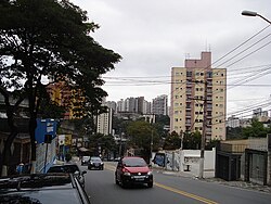
 Voluntários da Pátria street | |
| Country | Brazil |
| State | São Paulo |
| City | São Paulo |
| Government | |
| • Type | Subprefecture |
| • Subprefect | Helio Rubens Gonçalves Figueiredo |
| Area | |
| • Total | 12.6 km2 (4.9 sq mi) |
| Population (2000) | |
| • Total | 103.113 |
| HDI | 0.885 –high |
| Website | Subprefecture of Santana |
Mandaqui is a district in the city of São Paulo, Brazil.
23°28′06″S 46°38′28″W / 23.46833°S 46.64111°W

