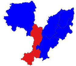
Myitkyina Township
Appearance
Myitkyina Township
မြစ်ကြီးနားမြို့နယ် | |
|---|---|
 Location in Myitkyina district | |
| Country | |
| State | Kachin State |
| District | Myitkyina District |
| Area | |
| • Total | 1,857.1 sq mi (4,809.9 km2) |
| Population (2014) | 306,949 |
| Time zone | UTC+6:30 (MST) |
Myitkyina Township (Burmese: မြစ်ကြီးနားမြို့နယ်) is a township (sub district) of Myitkyina District in Kachin State, Burma. The principal town is Myitkyina.
Demographics
2014
| Year | Pop. | ±% |
|---|---|---|
| 1973 | — | |
| 1983 | — | |
| 2014 | 306,949 | — |
| Source: Ministry of Labor, Immigration, and Population data | ||
The 2014 Myanmar Census reported that Myitkyina Township had a population of 306,949.[1] The population density was 63.8 people per km².[1] The census reported that the median age was 24.5 years, and 94 males per 100 females.[1] There were 50,583 households; the mean household size was 5.4.[1]
References
- ^ a b c d "Myitkyina Township Report" (PDF). 2014 Myanmar Population and Housing Census. October 2017.
26°15′00″N 97°30′00″E / 26.2500°N 97.5000°E


