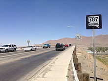
Nevada State Route 787
Route map:
| Hanson Street | ||||
| Route information | ||||
| Maintained by NDOT | ||||
| Length | 0.497 mi[1] (800 m) | |||
| Major junctions | ||||
| West end | ||||
| East end | ||||
| Location | ||||
| Country | United States | |||
| State | Nevada | |||
| Highway system | ||||
| ||||
| ||||
State Route 787 (SR 787) is a very short state highway in Humboldt County, Nevada, United States. SR 787 primarily serves as a connector road in Winnemucca.

Major intersections
The entire route is in Winnemucca, Humboldt County.
| mi[1] | km | Destinations | Notes | ||
|---|---|---|---|---|---|
| 0.000 | 0.000 | ||||
| 0.497 | 0.800 | ||||
| 1.000 mi = 1.609 km; 1.000 km = 0.621 mi | |||||
See also
KML is not from Wikidata
References
- ^ a b Nevada Department of Transportation (January 2017). "State Maintained Highways of Nevada: Descriptions and Maps". Retrieved 2017-01-13.
Wikimedia Commons has media related to Nevada State Route 787.

