
Nienburg, Lower Saxony
Nienburg | |
|---|---|
_COA.svg) Coat of arms | |
Location of Nienburg within Nienburg district 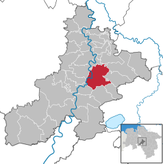 | |
 Nienburg  Nienburg | |
| Coordinates: 52°38′28″N 9°12′25″E / 52.64111°N 9.20694°E | |
| Country | Germany |
| State | Lower Saxony |
| District | Nienburg |
| Subdivisions | 4 districts |
| Government | |
| • Mayor (2021–26) | Jan Wendorf[1] (Ind.) |
| Area | |
| • Total | 64.45 km2 (24.88 sq mi) |
| Elevation | 25 m (82 ft) |
| Population (2022-12-31)[2] | |
| • Total | 32,126 |
| • Density | 500/km2 (1,300/sq mi) |
| Time zone | UTC+01:00 (CET) |
| • Summer (DST) | UTC+02:00 (CEST) |
| Postal codes | 31582 |
| Dialling codes | 05021 |
| Vehicle registration | NI |
| Website | Nienburg.de |
Nienburg (German: [ˈniːn.ˌbʊʁk] , official name: Nienburg/Weser) (Low German: Nienborg, Neenborg or Negenborg) is a town and capital of the district Nienburg, in Lower Saxony, Germany.
Geography
[edit]Situated on the scenic German Timber-Frame Road, Nienburg lies on the river Weser, approximately 55 km (34 mi) southeast of Bremen, and 45 km (28 mi) northwest of Hanover. Nienburg is the largest town in the Middle Weser Region.
Demography
[edit]| Year | 1987 | 1992 | 1997 | 1998 | 1999 | 2000 | 2001 | 2002 | 2003 | 2004 | 2005 | 2006 | 2007 | 2008 | 2009 | 2010 | 2011 |
|---|---|---|---|---|---|---|---|---|---|---|---|---|---|---|---|---|---|
| Population | 29,427 | 31,444 | 32,837 | 32,789 | 32,659 | 32,611 | 32,454 | 32,462 | 32,543 | 32,691 | 32,803 | 32,764 | 32,384 | 32,205 | 32,152 | 31,924 | 31,862 |
(as of Dec. 31st)[3]
 |


Structure
[edit]Nienburg, including quarters
- Erichshagen
- Holtorf
- Langendamm
- Schäferhof/Kattriede
- Nordertor
- Leintor
- Lehmwandlung
- Alpheide
History
[edit]The major reason for the emergence and development of Nienburg into the largest city in the Middle Weser region was its location at a convenient ford in the Weser River, leading to multiple trade routes radiating from the location. As early as 1025 the location was referred to as Negenborg, i.e. New Castle. In 1215 it began to be referred to as a city, a civitas, when Count Henry I of Hoya began the residence of his ruling line. From 1582 until 1866 the Guelph (Welf) Dukes of Brunswick-Lüneburg controlled the county, except for Napoleonic French rule from 1803 to 1813.[4] In 1871, it became part of the German Empire.
During World War II, it was the location of German prisoner-of-war camps Oflag X-B and Stalag X-C, in which French, Polish, Belgian, Romanian, Serbian, Italian and Soviet POWs were held.
In the wake of the war, a large number of livestock was killed in the region by an unknown predator, called Lichtenmoor Strangler.
The former County of Wölpe was the seat of the Grafen (counts) von Wölpe with its associated castle. The castle (Burg Wölpe) was destroyed in the Hildesheim Diocesan Feud in 1522. [citation needed]
Politics
[edit]Mayor
[edit]Since the 2021 elections, the mayor is Jan Wendorf (independent).[1] The previous mayor was Henning Onkes (independent). He was reelected in 2014 against three competitors.[5]
Local council (Stadtrat)
[edit]The 38 members of the "Stadtrat" are divided among:
- CDU: 13, among them the second deputy mayor Wilhelm Schlemermeyer
- SPD:14, among them the first deputy mayor Rolf Warnecke
- Alliance 90/The Greens: 6, among them the third deputy mayor Hedda Freese
- FDP: 1
- Wählergemeinschaft - Independent Union of Citizens WG 3
- The Left (Germany): 1
- One additional vote by the elected mayor of Nienburg, Mr. Henning Onkes, who doesn't belong to any political party
The elections in September 2016 showed the following results:
- CDU: 13 seats
- SPD: 12 seats
- Alliance 90/The Greens: 5 seats
- Wählergruppe Nienburg: 3seats
- FDP: 2 seats
- THE LEFT: 2 seats
- ULN: 1 seat
Twin towns – sister cities
[edit] Bartoszyce, Poland
 Las Cruces, New Mexico, United States
 Nienburg, Saxony-Anhalt, Germany
 Vitebsk, Belarus
Notable people
[edit],_Th-01137.jpg)
- Johann Georg Steigerthal (1666–1740), a court physician to George I of Great Britain in Hanover.
- Ernst Teichmann (1869–1919), theologian and zoologist, worked on the tsetse fly
- Heinrich Lübbe (1884–1940), engineer, worked for Dutch aircraft designer Anthony Fokker
- Kurt Matthaei (1886–1974), lawyer and a Nazi Party politician
- Ernst Thoms (1896–1983), a New Objectivity painter
- Oskar Gröning (1921–2018), SS Unterscharführer at the Auschwitz concentration camp
- Lutz Meyer-Gossner (born 1936), judge at the Federal Court from 1983 to 2001
- Angelika Neuwirth (born 1943), an Islamic studies scholar
- Susanne Schröter (born 1957), contemporary social Anthropologist
- Carsten Sieling (born 1959), politician, mayor and president of the senate of the Free Hanseatic City of Bremen (SPD)
- Maja Maranow (1961–2016), actress
Sport
[edit]- Volker Finke (born 1948), football coach
- Christine Traurig (born 1957), an American equestrian, bronze medallist in team dressage at the 2000 Summer Olympics
- Levent Ayçiçek (born 1994), footballer, played over 320 games
See also
[edit]References
[edit]- ^ a b "Stichwahlen zu Direktwahlen in Niedersachsen vom 26. September 2021" (PDF). Landesamt für Statistik Niedersachsen. 13 October 2021.
- ^ "LSN-Online Regionaldatenbank, Tabelle A100001G: Fortschreibung des Bevölkerungsstandes, Stand 31. Dezember 2022" (in German). Landesamt für Statistik Niedersachsen.
- ^ "Home". Nls.niedersachsen.de. Retrieved 29 November 2017.
- ^ "Startseite - Stadt Nienburg/Weser". Nienburg.de. Retrieved 29 November 2017.
- ^ "Nach dem vorläufigen Ergebnis der Direktwahl ist eine Stichwahl erforderlich" (PDF). Landeswahlleiter.niedersachsen.de. Archived from the original (PDF) on 3 March 2016. Retrieved 29 November 2017.
- ^ "Startseite". nfww.de (in German). Nienburg – Freundschaften weltweit e.V. Retrieved 2021-03-03.
External links
[edit]- Official website
 (in German)

| International | |
|---|---|
| National | |
| Geographic | |