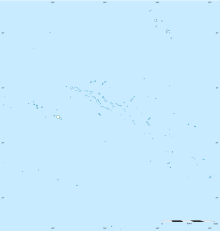
Rurutu Airport
Appearance
This article needs additional citations for verification. (March 2022) |
Rurutu Airport | |||||||||||
|---|---|---|---|---|---|---|---|---|---|---|---|
 | |||||||||||
| Summary | |||||||||||
| Serves | Rurutu | ||||||||||
| Location | Rurutu, French Polynesia | ||||||||||
| Hub for | Air Tahiti | ||||||||||
| Elevation AMSL | 3 m / 10 ft | ||||||||||
| Coordinates | 22°25′55″S 151°21′58″W / 22.43194°S 151.36611°W | ||||||||||
| Map | |||||||||||
 | |||||||||||
| Runways | |||||||||||
| |||||||||||
Rurutu Airport is an airport on Rurutu in French Polynesia (IATA: RUR, ICAO: NTAR). The airport is located 2.5 kilometres (1.6 mi) northeast of Moerai. The airport was built in 1977.[2]
Airlines and destinations
Passenger
| Airlines | Destinations |
|---|---|
| Air Tahiti | Papeete, Rimatara, Tubuai-Mataura |
Statistics
Graphs are unavailable due to technical issues. There is more info on Phabricator and on MediaWiki.org. |
Annual passenger traffic at RUR airport.
See Wikidata query.
References
- ^ "Rurutu Airport". Airports Worldwide. Retrieved 13 November 2021.
- ^ "With surfboard to Rurutu, in the French Australs". Pacific Islands Monthly. Vol. 50, no. 11. 1 November 1979. p. 43. Retrieved 12 March 2022 – via National Library of Australia.
External links
- NTAR – RURUTU. AIP from French Service d'information aéronautique, effective 31 October 2024.

