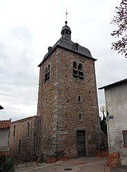
Saint-Germain-Laval, Loire
Saint-Germain-Laval | |
|---|---|
Commune | |
 | |
| Coordinates: 45°49′51″N 4°00′48″E / 45.8308°N 4.0133°E | |
| Country | France |
| Region | Auvergne-Rhône-Alpes |
| Department | Loire |
| Arrondissement | Roanne |
| Canton | Boën-sur-Lignon |
| Intercommunality | Vals d'Aix et d'Isable |
| Government | |
| • Mayor (2020–2026) | Jean-Claude Raymond[1] |
| Area 1 | 17.08 km2 (6.59 sq mi) |
| Population (2021)[2] | 1,604 |
| • Density | 94/km2 (240/sq mi) |
| Time zone | UTC+01:00 (CET) |
| • Summer (DST) | UTC+02:00 (CEST) |
| INSEE/Postal code | 42230 /42260 |
| Elevation | 344–526 m (1,129–1,726 ft) (avg. 430 m or 1,410 ft) |
| 1 French Land Register data, which excludes lakes, ponds, glaciers > 1 km2 (0.386 sq mi or 247 acres) and river estuaries. | |
Saint-Germain-Laval (French pronunciation: [sɛ̃ ʒɛʁmɛ̃ laval] ⓘ) is a commune in the Loire department in central France.[3]
The North American explorer Daniel Greysolon, Sieur du Lhut was born in Saint-Germain-Laval.
Geography[edit]
The commune is located in the plain of Forez, in the center of departement of Loire, in the center of France, 35 kilometers south of Roanne, 52 kilometers north-west of Saint-Etienne and 37 kilometers east of Thiers.
It is crossed by the Aix river, a tributary of the Loire which flows less than ten kilometers to the east. A The commune is 6 kilometers south of exit 5 of A89 autoroute linking Clermont-Ferrand (Auvergne, 85 km distant) to Saint-Étienne (62 km distant).
Population[edit]
| Year | Pop. | ±% p.a. |
|---|---|---|
| 1968 | 1,721 | — |
| 1975 | 1,777 | +0.46% |
| 1982 | 1,657 | −0.99% |
| 1990 | 1,510 | −1.15% |
| 1999 | 1,488 | −0.16% |
| 2009 | 1,649 | +1.03% |
| 2014 | 1,643 | −0.07% |
| 2020 | 1,610 | −0.34% |
| Source: INSEE[4] | ||
Twin towns[edit]
Saint-Germain-Laval is twinned with:
 San Germano, Italy
See also[edit]
- Communes of the Loire department
- Daniel Greysolon, Sieur du Lhut (c. 1639 – 1710), born in Saint-Germain-Laval. He is the namesake of Duluth, Minnesota as well as Duluth, Georgia
References[edit]
- ^ "Répertoire national des élus: les maires". data.gouv.fr, Plateforme ouverte des données publiques françaises (in French). 9 August 2021.
- ^ "Populations légales 2021". The National Institute of Statistics and Economic Studies. 28 December 2023.
- ^ INSEE commune file
- ^ Population en historique depuis 1968, INSEE
Wikimedia Commons has media related to Saint-Germain-Laval, Loire.


