
Washington State Route 107
State Route 107 | ||||
|---|---|---|---|---|
 SR 107 highlighted in red | ||||
| Route information | ||||
| Auxiliary route of US 101 | ||||
| Maintained by WSDOT | ||||
| Length | 7.93 mi[1] (12.76 km) | |||
| Existed | 1964[2]–present | |||
| Major junctions | ||||
| South end | ||||
| North end | ||||
| Location | ||||
| Country | United States | |||
| State | Washington | |||
| Counties | Grays Harbor | |||
| Highway system | ||||
| ||||

State Route 107 (SR 107) is a 7.93-mile-long (12.76 km) state highway serving Grays Harbor County in the U.S. state of Washington. The highway travels northeast from U.S. Route 101 (US 101) south of Cosmopolis to an interchange with US 12 in Montesano. SR 107 was created during the 1964 highway renumbering as the successor to a branch of Primary State Highway 9 (PSH 9), established earlier in 1937.
Route description[edit]

SR 107 begins at an intersection with US 101 in rural Grays Harbor County between Cosmopolis and Raymond. The highway travels north along the Little North River and east along the Chehalis River through the communities of Preachers Slough and Melbourne. SR 107 turns north in South Montesano and crosses the Chehalis River into the city of Montesano before the designation ends at a diamond interchange with US 12,[3] while the roadway continues north as Main Street into the city.[1][4]
Every year, the Washington State Department of Transportation (WSDOT) conducts a series of surveys on its highways in the state to measure traffic volume. This is expressed in terms of annual average daily traffic (AADT), which is a measure of traffic volume for any average day of the year. In 2011, WSDOT calculated that between 2,300 and 5,800 vehicles per day used the highway, mostly in the Montesano area.[5]
History[edit]
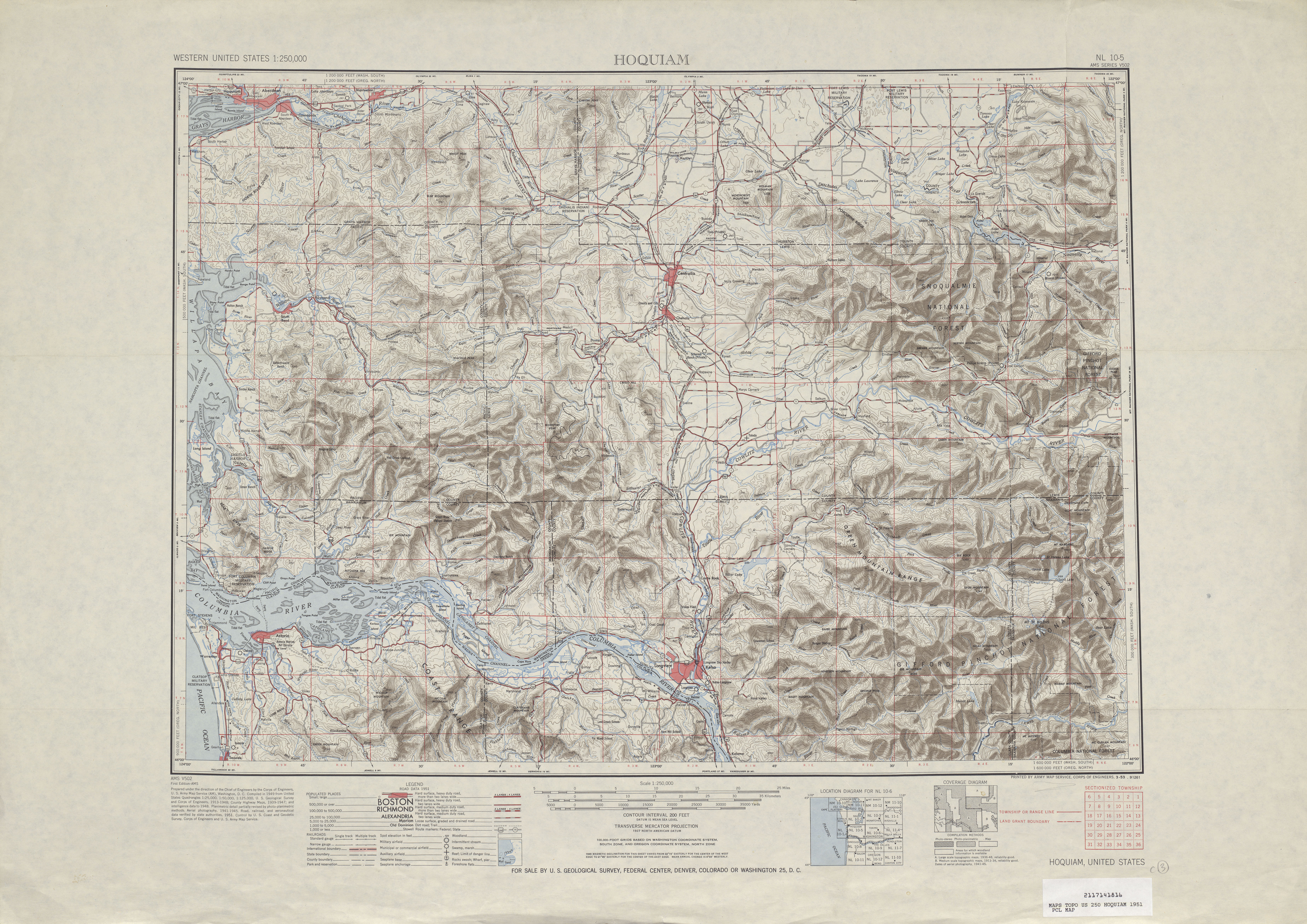
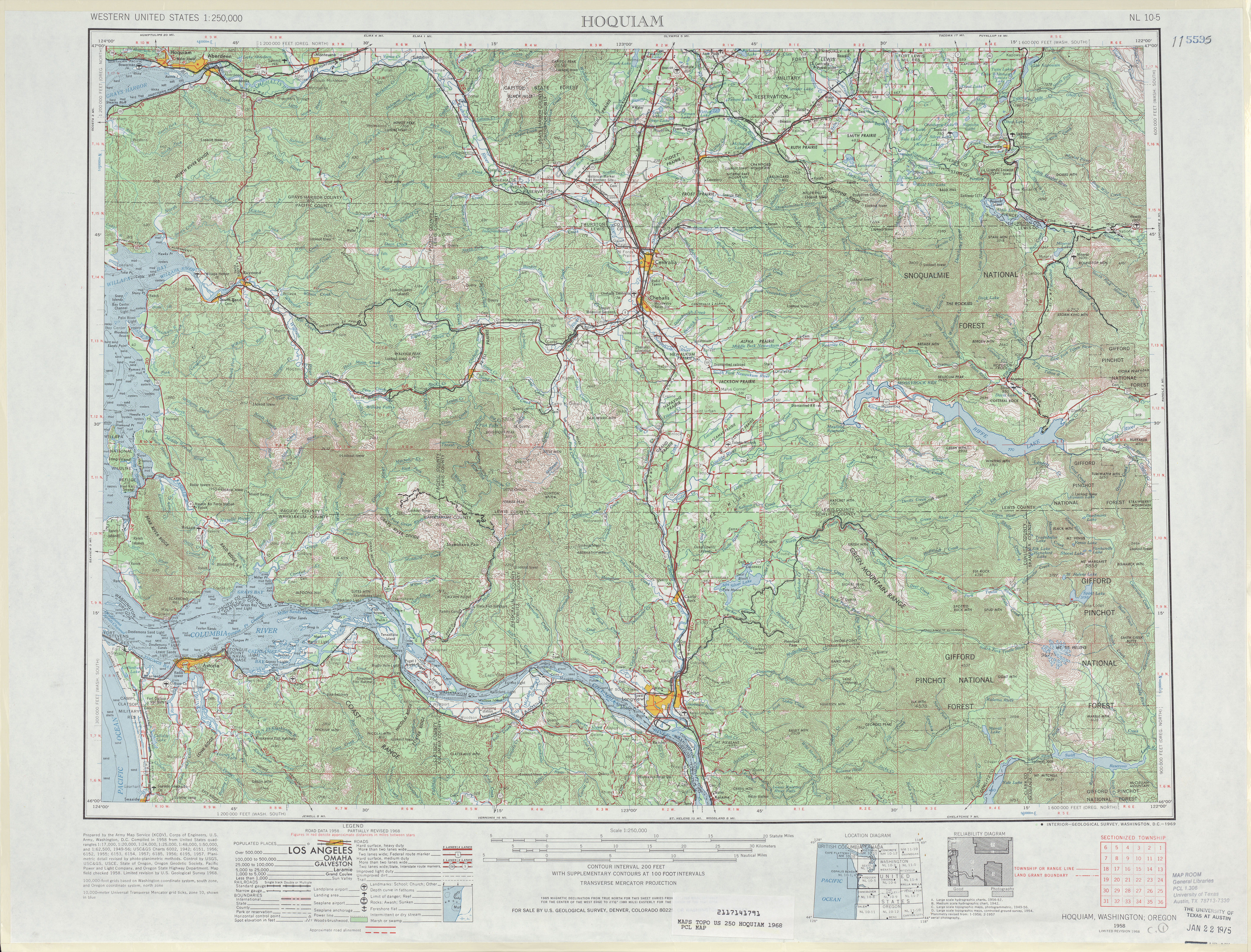
PSH 9 was created with the primary and secondary state highways in 1937, including a 8.28-mile-long (13.33 km) branch that connects the main highway and US 410 in Montesano to US 101 and PSH 14 near Artic.[6][7][8] The current truss bridge over the Chehalis River between South Montesano and Montesano was built in 1958 alongside two other bridges in the area by the Department of Highways.[9][10] SR 107 was established during the 1964 highway renumbering to replace the PSH 9 branch and was codified in 1970.[2][11][12] The new highway was truncated to its current terminus, a diamond interchange with US 12, after Montesano was bypassed by US 12 in 1967.[13] The highway is closed occasionally by seasonal flooding, most recently in 1994 and 2008.[14][15]
The 731-foot (223 m) Chehalis River bridge was rehabilitated by the state government from 2019 to 2021 at a cost of $25.2 million, funded by the Connecting Washington package passed in 2015.[16] The project included repainting the bridge's steel truss to prevent corrosion, replacing the bridge deck, and replacing the wooden trestle on the south approach with concrete and steel pilings.[9][17]
Major intersections[edit]
The entire highway is in Grays Harbor County.
| Location | mi[1] | km | Destinations | Notes | |
|---|---|---|---|---|---|
| | 0.00 | 0.00 | Southern terminus | ||
| Montesano | 7.87– 7.93 | 12.67– 12.76 | Northern terminus, interchange | ||
| 1.000 mi = 1.609 km; 1.000 km = 0.621 mi | |||||
References[edit]
- ^ a b c Staff (2012). "State Highway Log: Planning Report 2011, SR 2 to SR 971" (PDF). Washington State Department of Transportation. pp. 1003–1004. Retrieved February 14, 2013.
- ^ a b "47.17.190: State route No. 107". Revised Code of Washington. Washington State Legislature. 1970. Retrieved February 14, 2013.
- ^ "SR 12: Junction SR 107" (PDF). Washington State Department of Transportation. September 17, 2004. Retrieved February 14, 2013.
- ^ Google (November 22, 2010). "State Route 107" (Map). Google Maps. Google. Retrieved November 22, 2010.
- ^ Staff (2011). "2011 Annual Traffic Report" (PDF). Washington State Department of Transportation. Retrieved February 14, 2013.
- ^ Washington State Legislature (March 17, 1937). "Chapter 185: Establishment of Primary State Highways". Session Laws of the State of Washington (1937 ed.). Olympia, Washington: Washington State Legislature. p. 938. Retrieved February 14, 2013.
- ^ Hoquiam, 1951 (JPG) (Map). 1:250,000. United States Geological Survey. 1951. Retrieved February 14, 2013.
- ^ Staff (1960). Annual Traffic Report, 1960 (PDF). Washington State Highway Commission, Department of Highways. pp. 112–113. Retrieved February 14, 2013.
- ^ a b Hammock, Dan (July 29, 2019). "Wood trestle on SR 107 bridge making way for stronger concrete supports". The Daily World. Retrieved September 26, 2021.
- ^ Baker, Claudia (September 10, 2012). "Load restrictions lifted on 3 SR 107 bridges" (Press release). Washington State Department of Transportation. Retrieved February 14, 2013.
- ^ Prahl, C. G. (December 1, 1965). "Identification of State Highways" (PDF). Washington State Highway Commission, Department of Highways. Retrieved February 13, 2013.
- ^ Hoquiam, 1968 (JPG) (Map). 1:250,000. United States Geological Survey. 1968. Retrieved February 14, 2013.
- ^ Staff (1970). "Annual Traffic Report, 1970" (PDF). Washington State Highway Commission, Department of Highways. p. 126. Retrieved February 14, 2013.
- ^ "Water drives people from flooded homes". Moscow-Pullman Daily News. December 21, 1994. p. 3. Retrieved February 14, 2013.
- ^ "Flood watch: Waters affecting area roadways". Auburn Reporter. November 13, 2008. Retrieved February 14, 2013.
- ^ Hammock, Dan (May 6, 2021). "Two-way traffic reopens on State Route 107 Chehalis River Bridge in Montesano". The Daily News. Retrieved September 26, 2021.
- ^ "SR 107 - Chehalis River Bridge - Structure Rehabilitation - Complete May 2021". Washington State Department of Transportation. May 2021. Retrieved September 26, 2021.