Tenkodogo
Tenkodogo | |
|---|---|
 | |
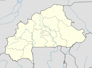
| Coordinates: 11°47′N 0°22′W / 11.783°N 0.367°W | |
| Country | |
| Region | Centre-Est Region |
| Province | Boulgou Province |
| Department | Tenkodogo Department |
| Elevation | 234 m (768 ft) |
| Population (2019 census)[1] | |
| • Total | 61,936 |
| Time zone | UTC+0 (GMT) |
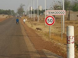
Tenkodogo is the capital city of Boulgou Province and the Centre-Est Region of Burkina Faso with a population of 61,936 (2019).[1][2]
Economy
The villages surrounding Tenkodogo are primarily based around animal husbandry.
The main market takes place every 3 days.
The Restaurant Patisserie Salon du Thé is known for its tea, yoghurt and pastries.
The Le Rotisseur restaurant is known for its grilled chicken.
Notable hotels include Hotel Djamou, Hotel Djamou Annexe, Hotel Laafi, and Auberge Riale.[3]
Politics
On 29 January 2016, the king of Tenkodogo, Naba Saga, died while in Thailand for hospital care.[4] He was the 28th king of Tenkodogo according to tradition and was inducted on 5 October 2001. He had taken the position after the death of his father, Naba Tigre, in September 2001. He was succeeded by Naba Guiguem-Pollé as king.[5]
Transport
The town is connected to Koupéla and Bittou, along the N15 highway.
Climate
Köppen-Geiger climate classification system classifies its climate as hot semi-arid (BSh) that closely borders with tropical wet and dry (Aw).
| Climate data for Tenkodogo | |||||||||||||
|---|---|---|---|---|---|---|---|---|---|---|---|---|---|
| Month | Jan | Feb | Mar | Apr | May | Jun | Jul | Aug | Sep | Oct | Nov | Dec | Year |
| Mean daily maximum °C (°F) | 34.2 (93.6) |
35.9 (96.6) |
38.9 (102.0) |
39.2 (102.6) |
36.5 (97.7) |
33.9 (93.0) |
31.5 (88.7) |
30.4 (86.7) |
31.6 (88.9) |
34.7 (94.5) |
36 (97) |
34.4 (93.9) |
34.8 (94.6) |
| Daily mean °C (°F) | 26.5 (79.7) |
28.6 (83.5) |
31.5 (88.7) |
32.4 (90.3) |
30.5 (86.9) |
28.4 (83.1) |
26.7 (80.1) |
25.9 (78.6) |
26.5 (79.7) |
28.4 (83.1) |
28.2 (82.8) |
26.6 (79.9) |
28.4 (83.0) |
| Mean daily minimum °C (°F) | 19.8 (67.6) |
21.3 (70.3) |
24.1 (75.4) |
25.6 (78.1) |
24.6 (76.3) |
23 (73) |
21.9 (71.4) |
21.4 (70.5) |
21.4 (70.5) |
22.1 (71.8) |
20.4 (68.7) |
18.8 (65.8) |
22.0 (71.6) |
| Average precipitation mm (inches) | 1 (0.0) |
3 (0.1) |
11 (0.4) |
26 (1.0) |
79 (3.1) |
110 (4.3) |
177 (7.0) |
243 (9.6) |
150 (5.9) |
35 (1.4) |
1 (0.0) |
2 (0.1) |
838 (32.9) |
| Source: Climate-Data.org, elevation: 309 m[6] | |||||||||||||
Demographics
| Year | Population |
|---|---|
| 1985 | 23,331[7] |
| 1996 | 31,466[7] |
| 2006 | 44,491[7] |
See also
References
- ^ a b Citypopulation.de Population of cities & localities in Burkina Faso
- ^ Manson, Katrina, Knight, James (2006). Burkina Faso. The Globe Pequot Press Inc. p. 183. ISBN 1-84162-154-4.
{{cite book}}:|work=ignored (help)CS1 maint: multiple names: authors list (link) - ^ Manson, Katrina, Knight, James (2006). Burkina Faso. The Globe Pequot Press Inc. p. 184. ISBN 1-84162-154-4.
{{cite book}}:|work=ignored (help)CS1 maint: multiple names: authors list (link) - ^ "Décès du roi de Tenkodogo : Qui était Naba Saga ? - leFaso.net, l'actualité au Burkina Faso". lefaso.net (in French). Retrieved 2017-03-10.
- ^ "Palais royal de Tenkodogo : Les autorités régionales sollicitent l'accompagnement de Naba Guiguem-Pollé". www.sidwaya.bf. Retrieved 2017-03-10.
- ^ "Climate: Tenkodogo - Climate graph, Temperature graph, Climate table". Climate-Data.org. Retrieved 19 October 2013.
- ^ a b c "La région du Centre-Est en chiffres" (PDF). 2011. Retrieved 9 March 2017.
External links
![]() Media related to Tenkodogo at Wikimedia Commons
Media related to Tenkodogo at Wikimedia Commons


