
Tollesby
| Tollesby | |
|---|---|
| Suburb | |
.svg) Tollesby Location within North Yorkshire | |
| OS grid reference | NZ510157 |
| Unitary authority | |
| Ceremonial county | |
| Region | |
| Country | England |
| Sovereign state | United Kingdom |
| Post town | MIDDLESBROUGH |
| Postcode district | TS4, 7 & 8 |
| Police | Cleveland |
| Fire | Cleveland |
| Ambulance | North East |
Tollesby is a residential area within the Middlesbrough ward of Ladgate in North Yorkshire, England. It is south-east of the Middlesbrough Municipal Golf Course.
The area was previously a separate hamlet near Marton-in-Cleveland before being absorbed with Middlesbrough, with its neighbour. The local schools are Easterside Academy, Holmwood and St Thomas More Primary.
Gallery
-
 Site of the former Tollesby Farm, the current buildings on site are sport facilities
 -
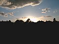 A sunset in Tollesby
 -
 A tree at a sunset in Tollesby
 -
 Viking sculpture denoting Tollesby's Viking origin


This Middlesbrough location article is a stub. You can help Wikipedia by expanding it. |