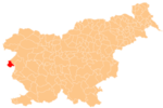
Vrhovlje pri Kožbani
Appearance
Vrhovlje pri Kožbani | |
|---|---|
| Coordinates: 46°2′50.73″N 13°31′21.04″E / 46.0474250°N 13.5225111°E | |
| Country | |
| Traditional region | Slovenian Littoral |
| Statistical region | Gorizia |
| Municipality | Brda |
| Area | |
| • Total | 2.68 km2 (1.03 sq mi) |
| Elevation | 424.6 m (1,393.0 ft) |
| Population (2020) | |
| • Total | 19 |
| • Density | 7.1/km2 (18/sq mi) |
| [1] | |
Vrhovlje pri Kožbani (pronounced [ʋəɾˈxoːu̯ljɛ pɾi kɔˈʒbaːni]) is a small settlement northwest of Kožbana in the Municipality of Brda in the Littoral region of Slovenia on the border with Italy.[2]
Name
The name of the settlement was changed from Vrhovlje to Vrhovlje pri Kožbani in 1953.[3] The settlement is also known as Vrhuje in the local dialect and humorously as Gluho Vrhovlje (literally, 'deaf Vrhovlje'),[4] in contrast to nearby Vrhovlje pri Kojskem ('blind Vrhovlje').
Church
The local church is dedicated to Saint Andrew and belongs to the Parish of Kožbana.[5]
Notable people
Notable people that were born or lived in Vrhovlje pri Kožbani include:
- Miloš Kamuščič (1852–1922), school teacher and writer[4]
References
- ^ Statistical Office of the Republic of Slovenia
- ^ Brda municipal site
- ^ Spremembe naselij 1948–95. 1996. Database. Ljubljana: Geografski inštitut ZRC SAZU, DZS.
- ^ a b Savnik, Roman (1968). Krajevni leksikon Slovenije, vol. 1. Ljubljana: Državna založba Slovenije. p. 234.
- ^ "Koper Diocese list of churches" (PDF). Archived from the original (PDF) on 2009-03-06. Retrieved 2009-03-06.


