Akuku-Toru
Akuku-Toru
Akulga | |
|---|---|
| Coordinates: 4°33′36″N 6°44′59″E / 4.56000°N 6.74972°E | |
| Country | Nigeria |
| State | Rivers State |
| Date created | 1990 |
| Seat | Abonnema |
| Government | |
| • Local Government Chairman | Rowland Sekibo (PDP) |
| • Deputy Local Government Chairman | Caroline West (PDP) |
| • Local Government Council | Ward 1: Emmanuel Anabraba (PDP) Ward 2: Da-Omonaa Sunday (PDP) Ward 3: Samuel Reginald Sokari (PDP) Ward4: Sibo-Ofori Lawrence (PDP) Ward 5: Henry David Bestman (PDP) Ward 6: Otonye Dickson Briggs (PDP) Ward 7: Sundayba West Asatty (PDP) Ward 8: Tonye Briggs (PDP) Ward 9: Joseph Fyneface (PDP) Ward 10: Inemary Jack (PDP) Ward 11: Clinton Timi Clinton (PDP) Ward 12: Dedeba Briggs (PDP) Ward 13: Omonaa Oliver (PDP) Ward 14: Chidinma Everett (PDP) Ward 15: Nelson Whoknows (PDP) Ward 16: Victor Sam (PDP) Ward 17: Obibisom Bray (PDP) |
| Area | |
| • Land | 557 sq mi (1,443 km2) |
| Time zone | UTC+1 (WAT) |
| postal code | 504[1] |
 | |
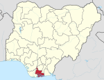
Akuku-Toru is a Local Government Area in Rivers State, Nigeria. Its headquarters are in the town of Abonnema.
It has an area of 1,443 km2 and a population of 156,006 at the 2006 census.
Wards[edit]
- Alise Group
- Briggs I
- Briggs II
- Briggs III
- Georgewill I
- Georgewill II
- Georgewill III
- Jack I
- Jack II
- Jack III
- Kula I
- Kula II
- Manuel I
- Manuel II
- Manuel III
- North/South Group
- Obonoma
References[edit]
- ^ "Post Offices- with map of LGA". NIPOST. Archived from the original on 7 October 2009. Retrieved 2009-10-20.
- ^ "Nigeria decide 2019 - Nigeria 2019 Elections information | Polling Unit Locator". nigeriadecide.org. Retrieved 2019-08-29.


