Báta: Difference between revisions
Appearance
Content deleted Content added
m r2.5.1) (robot Adding: sl:Báta |
Thehoboclown (talk | contribs) +county nav template |
||
| Line 1: | Line 1: | ||
{{Infobox Hungarian settlement |
{{Infobox Hungarian settlement |
||
| name = Báta |
| name = Báta |
||
| image_skyline = |
| image_skyline = |
||
| region = Dél-Dunántúl |
| region = Dél-Dunántúl |
||
| county = Tolna |
| county = Tolna |
||
| Line 24: | Line 24: | ||
{{Reflist}} |
{{Reflist}} |
||
{{coord|46.12640|N|18.77167|E|source:nlwiki_region:HU_type:city|format=dms|display=title}} |
{{coord|46.12640|N|18.77167|E|source:nlwiki_region:HU_type:city|format=dms|display=title}} |
||
{{Tolna}} |
|||
{{DEFAULTSORT:Bata}} |
{{DEFAULTSORT:Bata}} |
||
Revision as of 11:40, 5 January 2012
Template:Infobox Hungarian settlement
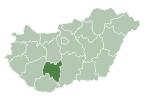
Báta is a village in Tolna County, Hungary.
References
46°07′35″N 18°46′18″E / 46.12640°N 18.77167°E


