
State Line, Texas
State Line, Texas | |
|---|---|
 State Line  State Line | |
| Coordinates: 31°59′53″N 104°32′5″W / 31.99806°N 104.53472°W | |
| Country | United States |
| State | Texas |
| County | Culberson |
| Elevation | 3,944 ft (1,202 m) |
| Time zone | UTC-7 (Mountain (MST)) |
| • Summer (DST) | UTC-6 (MDT) |
| Area code | 432 |
| GNIS feature ID | 2034720[1] |
State Line is an unincorporated community in Culberson County, Texas, United States.[1] According to the Handbook of Texas, the community had a population of 18 in 2000.
History
[edit]State Line had a population of 18 in 2000.[2]
Education
[edit]Today, the community is served by the Culberson County-Allamoore Independent School District.
References
[edit]
Municipalities and communities of Culberson County, Texas, United States | ||
|---|---|---|
| Town | 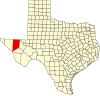 | |
| Unincorporated communities | ||
| Ghost towns | ||