Rotspitz
Appearance
This article relies largely or entirely on a single source. (November 2021) |
| Rotspitz | |
|---|---|
| Highest point | |
| Elevation | 2,127 m (6,978 ft) |
| Coordinates | 47°03′30″N 9°33′05″E / 47.05833°N 9.55139°E |
| Geography | |
| Location | Liechtenstein |
| Parent range | Rätikon, Alps |
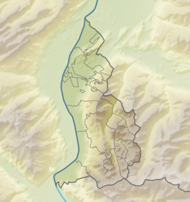
Rotspitz (literally redpeak) is a mountain in Liechtenstein, located close to the Swiss border, due east of the Swiss town of Wartau. It is in the Rätikon range of the Eastern Alps, and reaches a height of 2,127 metres (6,978 ft).
References
[edit]

