Nashua River: Difference between revisions
Ken Gallager (talk | contribs) →History: link paper mill |
No edit summary |
||
| Line 33: | Line 33: | ||
==External links== |
==External links== |
||
*[http://www.nashuariverwatershed.org/ Nashua River Watershed Association] |
*[http://www.nashuariverwatershed.org/ Nashua River Watershed Association] |
||
*[http://www.catfish-and-more.com/retro/wels-jahrbuch-1993/wels-jahrbuch-1993-h-j-franke-harnischwelsfang-im-rio-huacamayo-und-rio-neshua/ Franke, Hanns-Joachim: Harnischwelsfang im Rio Huacamayo und Rio Neshua] |
|||
[[Category:Tributaries of the Merrimack River]] |
[[Category:Tributaries of the Merrimack River]] |
||
Revision as of 07:11, 3 October 2011
| Nashua River | |
|---|---|
 | |
 | |
| Physical characteristics | |
| Mouth | Merrimack River |
| Length | 37.5 miles (60 km) |
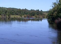
42°45′59″N 71°26′49″W / 42.76639°N 71.44694°W The Nashua River, 37.5 miles (60.4 km) long, is a tributary of the Merrimack River in Massachusetts and New Hampshire in the United States. It is formed in eastern Worcester County, Massachusetts, by junction of its north and south branches near Lancaster, and flows generally north-northeast past Groton to join the Merrimack at Nashua, New Hampshire. The Nashua River Watershed occupies a major portion of north-central Massachusetts and a much smaller portion of southern New Hampshire.
The north branch rises west of Fitchburg, flows about 30 miles (48 km) generally southeast past Fitchburg, and joins the south branch about 5 miles (8.0 km) below its issuance from the Wachusett Reservoir.
History
The Nashua River was heavily used for industry during the colonial period and the early United States. During the late 18th century and early 19th century, the heavy concentration of paper mills and the use of dyes near Fitchburg resulted in pollution that notoriously turned the river various colors downstream from the factories.
In the mid-1960s, Marion Stoddart started a campaign to restore the Nashua River and its tributaries. She built coalitions with labor leaders and business leaders, in particular the paper companies who were the worst polluters of the river. With federal help, eight treatment plants were built or upgraded along the river. A broad conservation buffer was created along about half the river and its two main tributaries. By the early-1990s, most of the industry was still located along the river, but many parts of the river were once again safe for swimming.
Recovery has sparked recreational use of the river at places like Mine Falls Park in Nashua.
See also
References
- "The Promise of Restoration", National Geographic Magazine, November, 1993, Special Edition: Water.
- Parfit, Michael, "New Ideas, New Understanding, New Hope", National Geographic Magazine, November, 1993, Special Edition: Water.
