
Łomianki: Difference between revisions
Content deleted Content added
No edit summary |
SlavPoland (talk | contribs) |
||
| Line 59: | Line 59: | ||
{{commons|Łomianki}} |
{{commons|Łomianki}} |
||
*[http://www.lomianki.pl Official site of town] {{language|pl}} |
*[http://www.lomianki.pl Official site of town] {{language|pl}} |
||
* [http://www.sztetl.org.pl/en/city/lomianki/ Jewish Community in Łomianki] on Virtual Shtetl |
|||
{{coord|52|20|N|20|53|E|region:PL_type:city|display=title}} |
{{coord|52|20|N|20|53|E|region:PL_type:city|display=title}} |
||
Revision as of 13:21, 24 March 2012
Łomianki | |
|---|---|
 Town center | |
 Flag  Coat of arms | |
| Country | Poland |
| Voivodeship | Masovian |
| County | Warsaw West |
| Gmina | Łomianki |
| Town rights | 1.01.1989 |
| Government | |
| • Mayor | Tomasz Dąbrowski (from 2011) (PO) |
| Area | |
| • Total | 8.4 km2 (3.2 sq mi) |
| Elevation | 73 m (240 ft) |
| Population (2008) | |
| • Total | 16,374 |
| • Density | 1,900/km2 (5,000/sq mi) |
| Time zone | UTC+1 (CET) |
| • Summer (DST) | UTC+2 (CEST) |
| Postal code | 05-092 |
| Area code | +48 22 |
| Car plates | WZ |
| Website | http://www.lomianki.pl/ |
Łomianki [wɔˈmʲaŋkʲi] is a town in Warsaw West County, Masovian Voivodeship, Poland[1], with 16,374 inhabitants (2008)[2].
Near Łomianki, there is a remarkale Vistula powerline crossing.
Gallery
-
 E77 road in Łomianki
 -
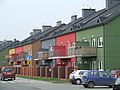 New settlement in town
 -
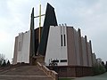 Parish church of Margaret the Virgin
 -
 Vistula powerline crossing


References
- ^ "Central Statistical Office (GUS) - TERYT (National Register of Territorial Land Apportionment Journal)" (in Polish). 2008-06-01.
- ^ "Central Statistical Office (GUS) - Ludność. Stan i struktura w przekroju terytorialnym (Stan w dniu 31 XII 2008 r.)" (PDF) (in Polish). 2009-07-19.
External links
Wikimedia Commons has media related to Łomianki.
- Official site of town Polish
- Jewish Community in Łomianki on Virtual Shtetl
52°20′N 20°53′E / 52.333°N 20.883°E
| Town and seat | | |
|---|---|---|
| Villages | ||
This Masovian Voivodeship location article is a stub. You can help Wikipedia by expanding it. |